We are in the process of migrating all NASA Earth science data sites into Earthdata from now until end of 2026. Not all NASA Earth science data and resources will appear here until then. Thank you for your patience as we make this transition.
Read about the Web Unification Project
Sentinel-2 MSI Resources
Earthdata resources for users working with NASA’s Multispectral Instrument include tutorials and other learning resources, news announcements such as instrument updates and data releases, user guides and related documents, and frequently asked questions.
Sentinel-2 MSI Learning Resources

Esta capacitación de ARSET cubre técnicas para mejorar las prácticas de gestión sostenible de la tierra.
Training
Feb. 5-19, 2019
Esta capacitación de ARSET cubre técnicas para mejorar prácticas de gestión sostenible de la tierra.
Training
Feb. 5-19, 2019

This ARSET training introduces participants to the use of satellite data for conservation and biodiversity applications.
Training
Jan. 22-24, 2019

This ARSET training covers change detection methods, including image subtraction, classification, and analysis.
Training
Sept. 28 - Oct. 5, 2018
SHOWING 4 OF 60
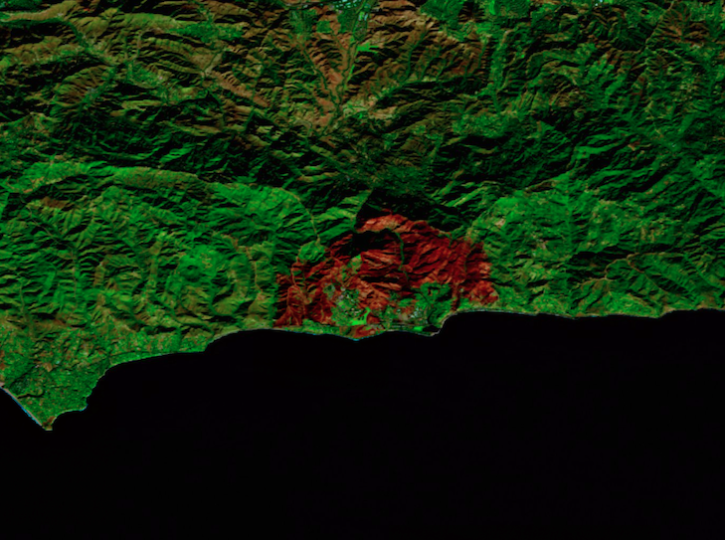
Image captured on Dec 18, 2024, by the MSI instrument aboard ESA's Sentinel-2B platform.
Worldview Image of the Week
Dec. 20, 2024

False-color reflectance image of burned areas near the Greek town of Marathon acquired on Aug 18, 2024.
Worldview Image of the Week
Aug. 22, 2024

A combination of Landsat and Sentinel-2 imagery, NASA near real-time data, and machine learning provides near real-time access to high-resolution water quality maps.
News
June 27, 2024

Global and US/Canada active Fire Maps enable users to visualize the location, extent, and impact of wildfires with minimal delay.
Feature Article
June 24, 2024
SHOWING 4 OF 64
Frequently Asked Questions
Earthdata Forum
Our online forum provides a space for users to browse thousands of FAQs about research needs, data, and data applications. You can also submit new questions for our experts to answer.
Submit Questions to Earthdata Forumand View Expert Responses