We are in the process of migrating all NASA Earth science data sites into Earthdata from now until end of 2026. Not all NASA Earth science data and resources will appear here until then. Thank you for your patience as we make this transition.
Read about the Web Unification Project
RADARSAT-1 Resources
Earthdata resources for users working with NASA’s RADARSAT-1 data include tutorials and other learning resources, news announcements such as instrument updates and data releases, user guides and related documents, and frequently asked questions.
RADARSAT-1 News
View All News
Filters
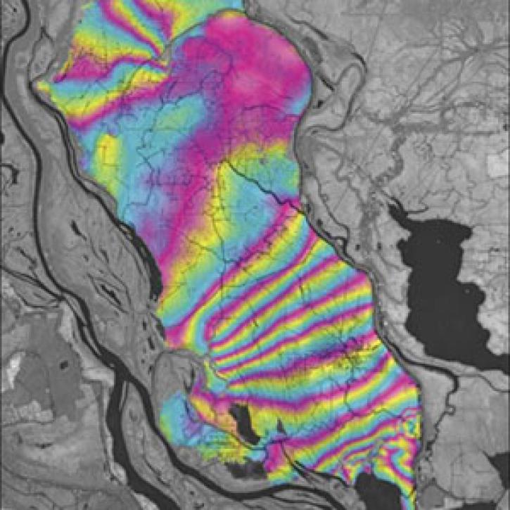
A technique to study land senses water-level changes in the Mississippi River delta.
Feature Article
July 28, 2020
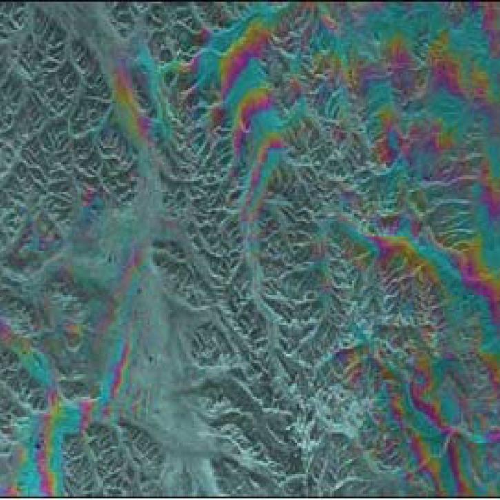
Alaska's Denali Fault experienced a magnitude 7.9 earthquake in 2002.
Feature Article
July 21, 2020
Anthropologists and archaeologists explore how people and the environment interact over thousands of years.
Feature Article
July 21, 2020
NASA's Radarsat Antarctic Mapping Project (RAMP) reveals how the continent is changing and how those changes will impact other regions of the Earth.
Feature Article
Sept. 17, 2017

As part of their 2006 Anniversary Edition, NASA’s Alaska Satellite Facility Distributed Active Archive Center (ASF DAAC) highlighted how the study of sea ice motion drives synthetic aperture radar research.
News
Jan. 1, 2006

Read the Alaska Satellite Facility 2006 anniversary feature highlighting the RADARSAT-1 Antarctic Mapping Project.
News
Jan. 1, 2006
SHOWING 6 OF 22
Frequently Asked Questions
Earthdata Forum
Our online forum provides a space for users to browse thousands of FAQs about research needs, data, and data applications. You can also submit new questions for our experts to answer.
Submit Questions to Earthdata Forumand View Expert Responses