- Nominal orbital height = 575 km
- Sun-synchronous around 10:30 a.m.
- 9-day repeat orbit
- Baseline orbital lifetime of 1 year (18-24 months)
- Baseline of 15 scenes per day (200 x 600 km of approximately 120 meter resolution - 100 MB/scene)
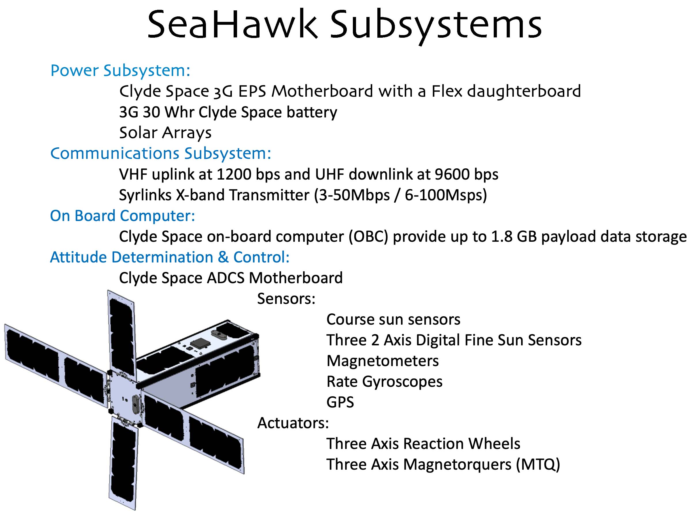
- X-band downlink (Wallops Flight Facility and Alaska) data rate of 6 - 100 mbps
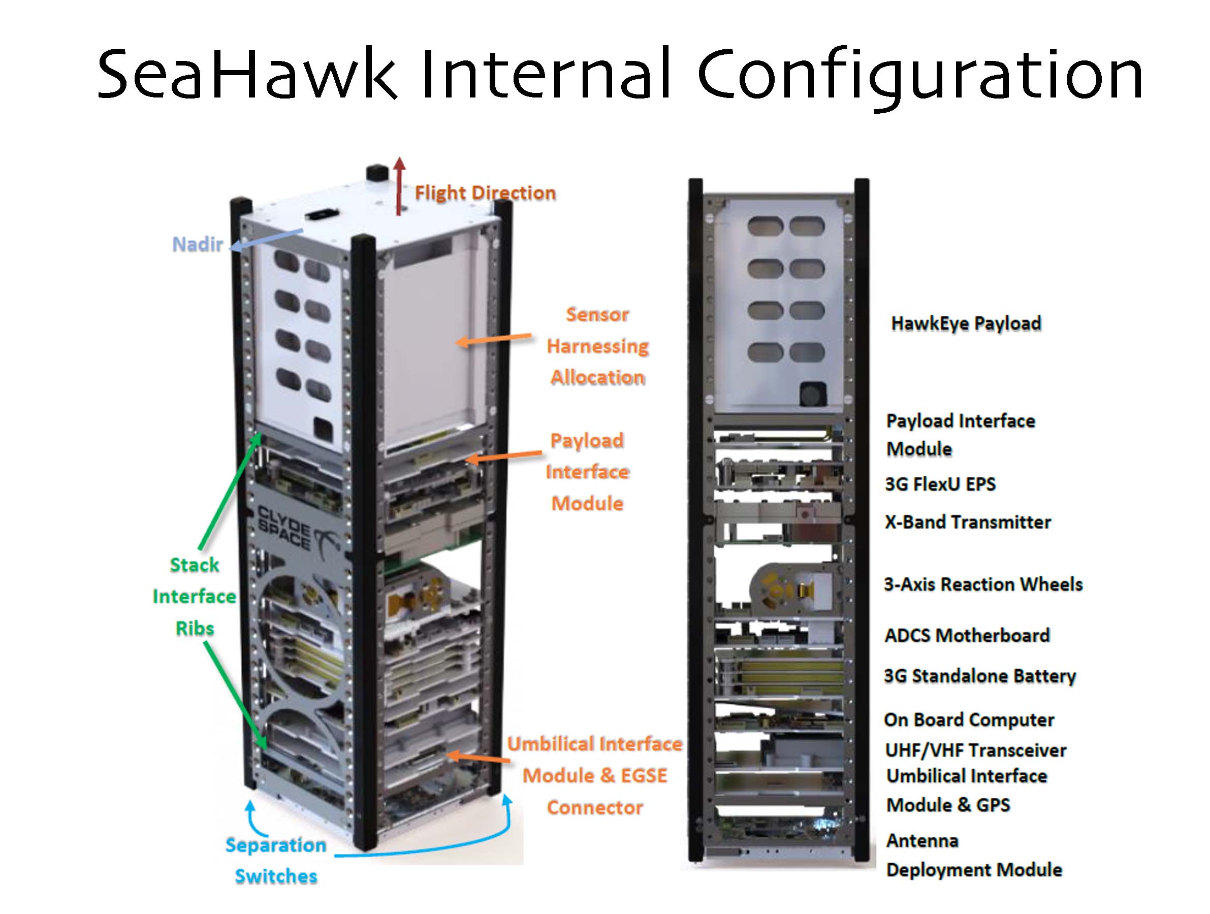
- Weight:
- Instrument: less than 1 kilogram
- Total (spacecraft plus instrument): less than 5 kilograms
- Off-the-shelf CCD arrays
- Sensitivity comparable to SeaWiFS
- Open intellectual property and knowledge sharing
Earthdata Forum is down due to unplanned maintenance. Please contact earthdata-support@nasa.gov with questions.
See the alert