We are in the process of migrating all NASA Earth science data sites into Earthdata from now until end of 2026. Not all NASA Earth science data and resources will appear here until then. Thank you for your patience as we make this transition.
Read about the Web Unification Project
Suomi NPP Resources
Suomi NPP Learning Resources

This ARSET training focuses on using NASA data products for monitoring human settlements and landscapes during armed conflict and forced displacement.
Training
June 14-23, 2022

This ARSET training focuses on introducing evapotranspiration (ET) products derived from remote sensing observations.
Training
June 1-15, 2022

Join us to learn how to search and order datasets from NASA's Level-1 and Atmosphere Archive and Distribution System Distributed Active Archive Center (LAADS DAAC). Subsetting, reprojection, and data output post-processing operations in the Find Data tool will also be featured.
Webinar
May 18, 2022

Looking to learn more about Suomi NPP VIIRS global land data products available from NASA? Join us for an overview of the data products and live demos on how to access and work with the data using a variety of tools from the Land Processes DAAC.
Webinar
April 20, 2022

Join us to learn how to discover, subset, access and visualize both MODIS and VIIRS data products using a suite of user-friendly tools developed by NASA's ORNL DAAC.
Webinar
April 19, 2022

Through NASA FIRMS, users can interactively view fire data via the Fire Map, search for both VIIRS and MODIS active fires/hotspots and sign-up to receive automated Fire Email Alerts for their geographic areas of interest. Join us to learn more!
Webinar
April 19, 2022

Want to learn how to use R and Python to work with remote sensing data? Join us as we demonstrate how to perform basic data preparation, processing, computation, and visualization techniques using ASTER and VIIRS Surface Reflectance data.
Webinar
April 18, 2022

Learn how SeaBASS can be leveraged for data search, discovery, and access, and will demonstrate how SeaBASS supports NASA’s ocean color satellite products and the broader scientific community.
Webinar
April 18, 2022
SHOWING 8 OF 67
Suomi NPP News
View All News
Filters

The Geostationary Earth Orbit (GEO) – Low-Earth Orbit (LEO) Dark Target Aerosol product suite enables users to track rapid changes and movements in smoke and dust plumes that can severely impact air quality.
News
March 19, 2024
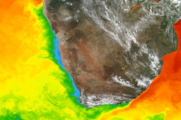
Base image captured March 5, 2024, by the Visible Infrared Imaging Radiometer Suite (VIIRS) instrument aboard the Suomi NPP satellite, overlaid with sea surface temperature.
Worldview Image of the Week
March 7, 2024

A summary of datasets, products, and resources released by NASA’s Distributed Active Archive Centers (DAACs) in Feb 2024.
News
March 4, 2024

The View Data tool lets users find and preview full-resolution MODIS and VIIRS atmospheric datasets prior to downloading.
Feature Article
Feb. 23, 2024
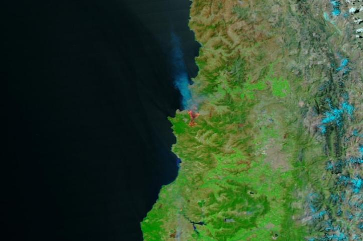
Image captured Feb 3, 2024, by the VIIRS instrument aboard the joint NASA/NOAA Suomi NPP satellite.
Worldview Image of the Week
Feb. 8, 2024

Base image captured Jan 31, 2024, by the VIIRS instrument aboard the joint NASA/NOAA NOAA-20 satellite, overlaid with IMERG Precipitation Rate.
Worldview Image of the Week
Feb. 1, 2024

NASA researchers are tweaking algorithms and combining data from multiple satellites to track tropical forest fires in Brazil.
Feature Article
Feb. 1, 2024
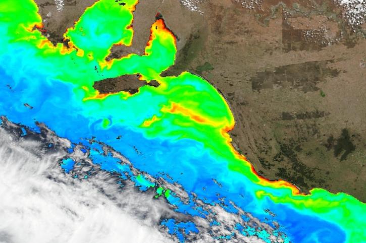
Base image captured Jan 12, 2024, by the VIIRS instrument aboard the joint NASA/NOAA Suomi NPP satellite, overlaid with Chlorophyll a.
Worldview Image of the Week
Jan. 12, 2024
SHOWING 8 OF 333
Frequently Asked Questions
Earthdata Forum
Our online forum provides a space for users to browse thousands of FAQs about research needs, data, and data applications. You can also submit new questions for our experts to answer.
Submit Questions to Earthdata Forumand View Expert Responses