We are in the process of migrating all NASA Earth science data sites into Earthdata from now until end of 2026. Not all NASA Earth science data and resources will appear here until then. Thank you for your patience as we make this transition.
Read about the Web Unification Project
Suomi NPP Resources
Suomi NPP Learning Resources

Esta capacitación de ARSET se centra en los datos de Black Marble y en cómo elegir el producto de iluminación nocturna adecuado.
Training
Dec. 3, 2020
This ARSET training focuses on building the skills needed to acquire and understand Black Marble data and choose the appropriate nighttime lights product.
Training
Dec. 3, 2020

This ARSET training covers the use of remote sensing in determining and explaining urban heat islands, and ways to mitigate the effects.
Training
Nov. 10-24, 2020

During this webinar we will introduce several of the NSIDC DAAC snow-focused NASA missions and data products, followed by a live demonstration teaching participants how to discover, access, and couple snow data across varying geospatial scales using Python.
Webinar
Nov. 4, 2020

This ARSET training covers how to access VIIRS data products, the differences between VIIRS and MODIS, and its air quality applications.
Training
Oct. 22, 2020

Esta formación ARSET abarca algunas de las dificultades asociadas a la teledetección de los ecosistemas costeros.
Training
Aug. 25 - Sept. 8, 2020
This ARSET training covers some of the difficulties associated with remote sensing of coastal ecosystems.
Training
Aug. 25 - Sept. 8, 2020

This ArcGIS Python Toolbox simplifies access to quality data by decoding complex quality information into usable thematic raster files.
Tutorial
Aug. 18, 2020
SHOWING 8 OF 67
Suomi NPP News
View All News
Filters

The Geostationary Earth Orbit (GEO) – Low-Earth Orbit (LEO) Dark Target Aerosol product suite enables users to track rapid changes and movements in smoke and dust plumes that can severely impact air quality.
News
March 19, 2024
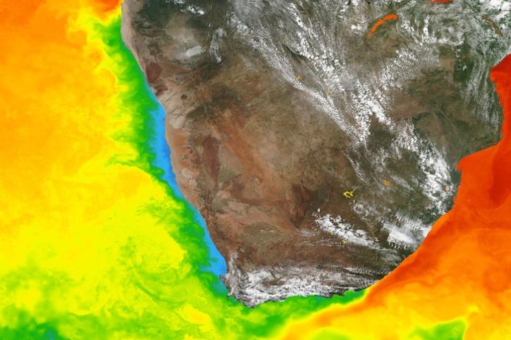
Base image captured March 5, 2024, by the Visible Infrared Imaging Radiometer Suite (VIIRS) instrument aboard the Suomi NPP satellite, overlaid with sea surface temperature.
Worldview Image of the Week
March 7, 2024

A summary of datasets, products, and resources released by NASA’s Distributed Active Archive Centers (DAACs) in Feb 2024.
News
March 4, 2024

The View Data tool lets users find and preview full-resolution MODIS and VIIRS atmospheric datasets prior to downloading.
Feature Article
Feb. 23, 2024
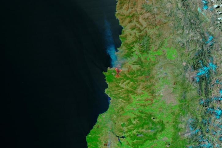
Image captured Feb 3, 2024, by the VIIRS instrument aboard the joint NASA/NOAA Suomi NPP satellite.
Worldview Image of the Week
Feb. 8, 2024

Base image captured Jan 31, 2024, by the VIIRS instrument aboard the joint NASA/NOAA NOAA-20 satellite, overlaid with IMERG Precipitation Rate.
Worldview Image of the Week
Feb. 1, 2024

NASA researchers are tweaking algorithms and combining data from multiple satellites to track tropical forest fires in Brazil.
Feature Article
Feb. 1, 2024
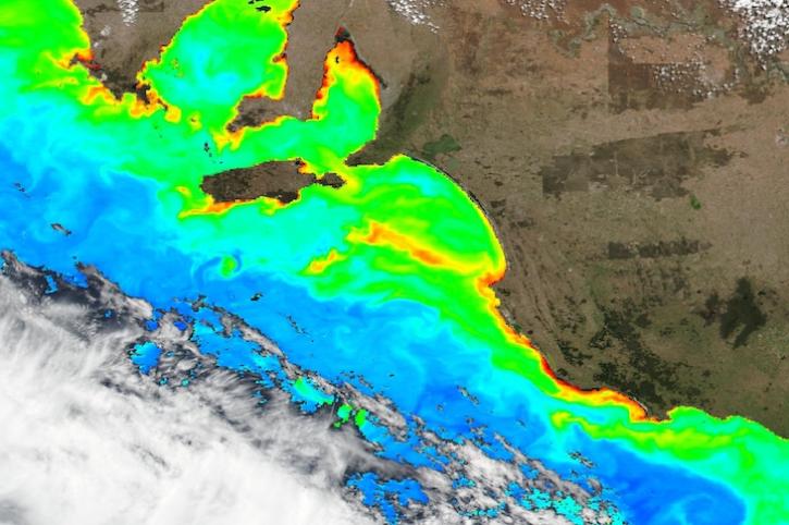
Base image captured Jan 12, 2024, by the VIIRS instrument aboard the joint NASA/NOAA Suomi NPP satellite, overlaid with Chlorophyll a.
Worldview Image of the Week
Jan. 12, 2024
SHOWING 8 OF 333
Frequently Asked Questions
Earthdata Forum
Our online forum provides a space for users to browse thousands of FAQs about research needs, data, and data applications. You can also submit new questions for our experts to answer.
Submit Questions to Earthdata Forumand View Expert Responses