We are in the process of migrating all NASA Earth science data sites into Earthdata from now until end of 2026. Not all NASA Earth science data and resources will appear here until then. Thank you for your patience as we make this transition.
Read about the Web Unification Project
SWOT Resources
SWOT Learning Resources

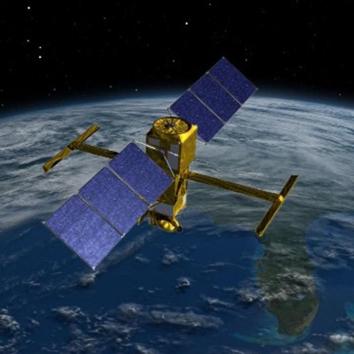
NASA’s SWOT satellite will measure sea level height variations on spatial scales down to a few kilometers.
Data in Action
Aug. 17, 2013
SHOWING 1 OF 17
SWOT News
View All News
Filters

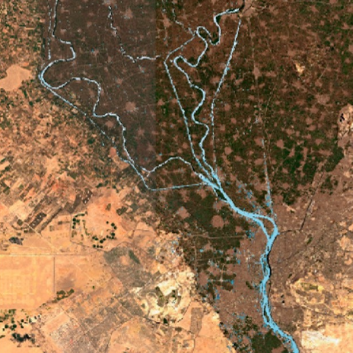
Recently released datasets from the SWOT mission provide scientists with previously unavailable measurements of Earth's surface water.
Feature Article
April 25, 2024

A summary of datasets, products, and resources released by NASA’s Distributed Active Archive Centers (DAACs) in March 2024.
News
April 3, 2024
A workshop hosted by NASA's Physical Oceanography Distributed Active Archive Center (PO.DAAC) explored data and resources for working with observations from the Surface Water and Ocean Topography (SWOT) mission.
Blog
March 18, 2024

NASA's PO.DAAC hosted a SWOT Data Access Workshop titled "Remote Sensing of the Water Cycle" at AGU Chapman in Feb. 2024.
Blog
Feb. 24, 2024

New instruments like the Ka-band Radar Interferometer present NASA Engineers with calibration and validation challenges.
Data User Story
Jan. 8, 2024

A summary of datasets, products, and resources released by NASA’s Distributed Active Archive Centers (DAACs) in December 2023.
News
Jan. 4, 2024

View a recording of the PO.DAAC open office hour that discusses the Surface Water and Ocean Topography (SWOT) data release.
News
Dec. 11, 2023
Careful calibration and validation ensure that the Surface Water and Ocean Topography mission will provide the best data possible.
Feature Article
March 17, 2023
SHOWING 8 OF 28
Frequently Asked Questions
Earthdata Forum
Our online forum provides a space for users to browse thousands of FAQs about research needs, data, and data applications. You can also submit new questions for our experts to answer.
Submit Questions to Earthdata Forumand View Expert Responses