We are in the process of migrating all NASA Earth science data sites into Earthdata from now until end of 2026. Not all NASA Earth science data and resources will appear here until then. Thank you for your patience as we make this transition.
Read about the Web Unification Project
Terra Resources
Terra Learning Resources

The Emergency Environmental Health Dashboard helped local communities assess water quality risks and infrastructure damage following Hurricane Helene and Tropical Storm Chantal.
Data in Action
Nov. 18, 2025

This ARSET training introduces participants to several capabilities within FIRMS that were not included in the previous ARSET training.
Training
Jan. 14-21, 2026

Join us on Wed., September 17, 2025, at 2:00 p.m. EDT (-04:00 UTC) to learn how to discover, access, and use NASA's near real-time global flood products .
Webinar
Aug. 29, 2025

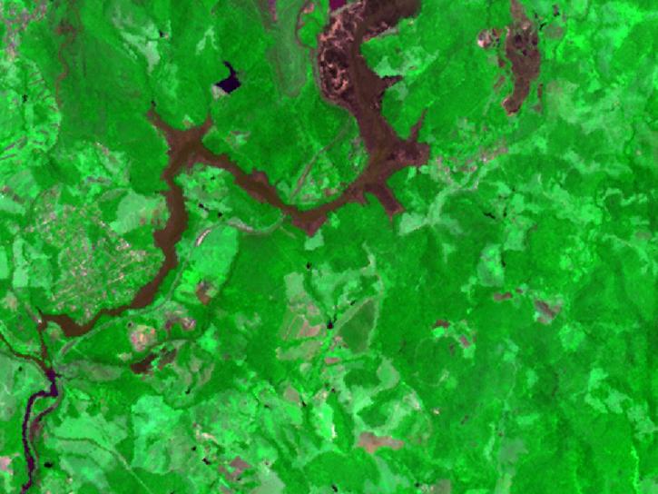
The MODIS Near Real-Time (NRT) Global Flood Product helps communities assess the aftermath of flooding in Australia.
Data in Action
July 17, 2025

Join NASA’s LAADS DAAC to learn how new tools available through Harmony services help users work with Level-1 and atmospheric datasets more efficiently.
Webinar
July 16, 2025

The eBird project uses NASA data and observations from amateur birdwatchers to provide insights into the decline in avian populations throughout North America.
Data in Action
June 17, 2025

Agricultural burning in Kansas produces smoky skies and healthy crops.
Data in Action
June 6, 2025

Artificial intelligence methods can be powerful tools to study our oceans.
Data in Action
Dec. 12, 2024
SHOWING 8 OF 235
Terra News
View All News
Filters

Image captured on 24 December 2018, by the MODIS instrument, aboard the Terra satellite.
Worldview Image of the Week
Feb. 26, 2020

Australian wildfires observations by the Cloud-Aerosol Lidar and Infrared Pathfinder Satellite Observations (CALIPSO) and Multi-angle Imaging SpectroRadiometer (MISR).
News
Feb. 25, 2020

Two new datasets are available from NASA's Socioeconomic Data and Applications Center.
News
Jan. 3, 2020
Version 3 of the ASTER GDEM product is available free of charge worldwide.
News
Aug. 5, 2019

Image captured on 28 April 2019, by the MODIS instrument, aboard the Terra satellite
Worldview Image of the Week
April 29, 2019

Worldview and the Global Imagery Browse Services (GIBS) are now offering near real-time true/natural color and infrared color imagery from the Multi-angle Imaging SpectroRadiometer (MISR) instrument on the Terra satellite.
Blog
Sept. 27, 2017
See a list of the most recent GIBS and Worldview imagery additions.
Blog
Sept. 1, 2017
Issues with VIIRS near real-time products and some MODIS near real-time atmosphere products have been resolved.
Blog
March 23, 2017
SHOWING 8 OF 450
Frequently Asked Questions
Earthdata Forum
Our online forum provides a space for users to browse thousands of FAQs about research needs, data, and data applications. You can also submit new questions for our experts to answer.
Submit Questions to Earthdata Forumand View Expert Responses