We are in the process of migrating all NASA Earth science data sites into Earthdata from now until end of 2026. Not all NASA Earth science data and resources will appear here until then. Thank you for your patience as we make this transition.
Read about the Web Unification Project
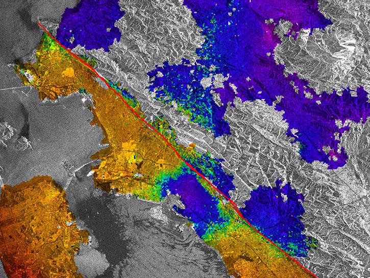
The ESA (European Space Agency) ERS program was the first ESA Earth observation program to provide microwave spectrum-based environmental monitoring.
32 datasets

The ESA (European Space Agency) ERS program was the first ESA Earth observation program to provide microwave spectrum-based environmental monitoring.
33 datasets
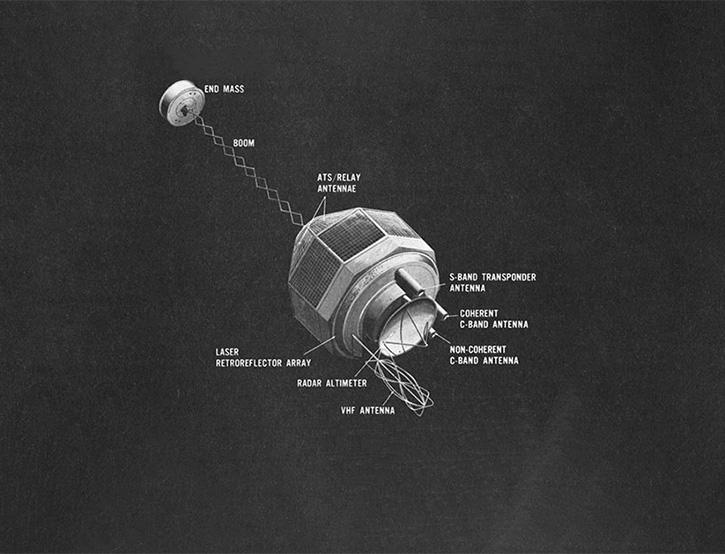
NASA's GEOS-3 set out to to measure the gravitational field around the Earth and map oceans.
3 datasets
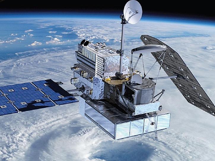
The Global Precipitation Measurement (GPM) provides next-generation global observations of rain and snow.
87 datasets
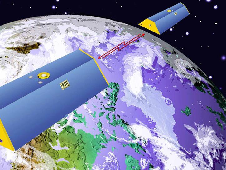
Two satellites—GRACE and GRACE Follow-on—travel in tandem and detect minute changes in distance between the satellite pairs caused by changes in gravity.
63 datasets

NASA's Ice, Cloud, and land Elevation Satellite (ICESat) provided multi-year ice sheet elevation measurements from 2003 to 2009.
65 datasets

NASA's Ice, Cloud, and Land Elevation Satellite-2 (ICESat-2) carries a photon-counting laser altimeter that allows scientists to measure the elevation of ice sheets, glaciers, sea ice, and more in unprecedented detail.
145 datasets

The International Space Station has many Earth science payloads that collect and contribute to NASA's Earth science data catalog.
198 datasets
SHOWING 8 OF 59