Study Dates | May 26, 1987 - Aug. 12, 1989 |
---|---|
Season of Study | Year round |
Region | Central Kansas |
Spatial Bounds | N: 40°N S: 37°N W: 102°W E: 95°W |
Focus Areas | Carbon Cycle and Ecosystems Earth Surface and Interior |
Geophysical Concepts | Earth/Climate Interactions Land Characteristics |
Scientific Topics | Atmosphere-Land Surface Interactions Biosphere-Atmosphere Interactions Atmospheric Dynamics Carbon Flux Water Cycle Satellite Remote Sensing Soil Moisture Vegetation Algorithm Development |


FIFE
The First International Satellite Land Surface Climatology Project (ISLSCP) Field Experiment (FIFE) team conducted field studies on a prairie site in Kansas from 1987 to 1989. FIFE Follow-on work included additional analyses of data collected during the initial field campaigns and additional field measurements.
The objectives of both FIFE and FIFE Follow-on were to understand the biophysical processes controlling the fluxes of radiation, moisture, and carbon dioxide between the land surface and the atmosphere, and to develop remote-sensing methodologies for observing these processes.
The general objectives of FIFE were to:
- Understand the biophysical processes controlling the fluxes of exchanges of radiation, moisture, and carbon dioxide between the land surface and the atmosphere.
- Develop and test remote-sensing methodologies for observing these processes at a pixel level.
- Understand how to scale the pixel-level information to regional scales commensurate with modeling of global processes.
Data Acquisition in FIFE
The data acquisition effort of FIFE can be divided into two broad categories: the monitoring effort and the Intensive Field Campaigns (IFCs).
- The monitoring effort, which operated more or less continuously through 1987, 1988, and 1989, consisted of the acquisition of AVHRR, Landsat, SPOT, and GOES satellite data; the continuous acquisition of relevant meteorological data from 16 automated meteorological stations within the site; the collection of gravimetric soil moisture surveys, streamflow data, and biometric measurements; and the observations of relevant atmospheric optical properties to study the effects of atmosphere on satellite remote-sensing images.
- The Intensive Field Campaigns (IFCs) had the specific objective of acquiring surface and airborne data in conjunction with the satellite overpasses to study the biophysical and energetic processes over spatial scales from millimeters to kilometers and temporal scales from seconds to an entire season. The IFCs required a large commitment of manpower and resources; thus, their combined duration during 1987 was only 57 days. The IFC periods targeted the critical phases of vegetative development (IFC-1 "greenup"; IFC-2 "peak greenness"; IFC-3 "dry-down"; IFC-4 "senescence"). In 1987 unusual weather conditions produced very similar conditions during the first three IFCs (wet soils and green vegetation) followed by a totally senescent vegetation cover and dry soil in IFC-4. During 1989 a 20-day (July 24-August 12) IFC was instituted to obtain the "dry down" missed during IFC-3.
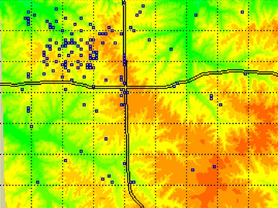
Ground Measurements
Ground measurements were acquired at 32 sites within the Konza and were complemented by a number of other measurement sites (e.g., a dense network of 42 rain gauges in a watershed). A probability sample of sites were placed within strata representing the major spatial variation in soil depth, seasonally integrated incident solar radiation and management practice (e.g. grazing and burning).
Science Teams
Roughly 100 science investigators and support staff were working at the FIFE site during the IFCs. In addition to the selected investigators working in FIFE, there were two large groups of scientists and support staff conducting measurements on site. One group based at Kansas State University (Staff/KSU) carried out a wide range of measurements for the monitoring program and during IFCs. The Goddard Space Flight Center group (Staff/GSFC) supported experiment design, developed and operated the FIFE Information System (FIS) and provided administrative support.
Aircraft Overflights
As part of the experiment, three aircraft (NASA C-130, NASA Helicopter, and NOAA Aerocommander) took radiometric measurements using a variety of scanners, radiometers, and scatterometers operating over the visible, near infrared, thermal, and microwave wavelength intervals. Three other aircraft (Canadian Twin Otter, National Center for Atmospheric Research KingAir, and University of Wyoming KingAir) took flux measurements of heat, moisture, momentum, and carbon dioxide (Twin Otter only) fluxes over the site. These activities were closely coordinated with each other and with satellite overpasses. In all some 180 missions and over 400 flight hours of aircraft flight time were dedicated to data acquisition during FIFE.
Scaling Up Analysis (Micro to Macro)
One of the long-range objectives of FIFE is to make interdisciplinary connections between ground data, aircraft data, and finally satellite data. By making direct comparisons between ground data and corresponding aircraft data, scientists hope to learn about resolving the differences between the two data types. Once these differences -- how to get accurate "ground" data from aircraft overflights -- are understood, scientists can attempt to link aircraft data with satellite data. The eventual goal is to be able to accurately collect "ground" data from satellite overflights. This requires a great deal of new knowledge on how the atmosphere affects measurements and how small-scale trends can be detected within large-scale systems.
Platform | Instrument(s) |
---|---|
C-130 Hercules | Advanced Solid-state Array Spectroradiometer (ASAS) Push Broom Microwave Radiometer (PBMR) Airborne Tracking Sun Photometer (ATSP) Thematic Mapper Simulator (TMS) Thermal Infrared Multispectral Scanner (TIMS) |
Rockwell Aero Commander | Generic-Gamma Ray Sensors (Gen-Gamma) |
Campaign Balloons | Radiosonde |
Beechcraft B-200 King Air | Rosemount Temperature Probes Rosemount Pressure Probes Lyman-alpha Hygrometer Pyrgeometer Gust Probe Generic-Atmospheric State (Gen-AtmsState) Side Looking Airborne Radar (SLAR) Video camera Active Scattering Aerosol Spectrometer Probe (ASASP) Pyranometer Thermo Scientific Gas Analyzer (Thermo Scientific Gas Analyzer) Precision Radiation Thermometer (PRT-5) Forward Scattering Spectrometer Probe (FSSP) King (CSIRO) Liquid Water Probe (King Probe) Chemiluminescence Instrument (NOx/NOxy) |
DeHavilland DHC-6-300 Twin Otter | Rosemount Temperature Probes Pyranometer Video camera Accelerometer Rosemount Pressure Probes Gust Probe Generic-Atmospheric State (Gen-AtmsState) Precision Radiation Thermometer (PRT-5) |
UH-1 Huey | Spectron Engineering-590 Spectroradiometer (SE-590) Modular Multiband Radiometer (MMR) C-Band Scatterometer (C-Band Scatterometer) Spectrometers |
Campaign Field Sites | Soil Temperature Sensor Stream Gauge Sunphotometer Soil Moisture Probe NOAA/WPL CO2 Doppler Lidar (NOAA/WPL Doppler Lidar) Generic-Atmospheric State (Gen-AtmsState) Generic-Radiometers (Gen-Radiometers) LI-COR Plant Canopy Analyzer (LI-COR Plant Canopy Analyzer) Volume Imaging LIDAR (VIL) Digital Camera LI-COR Quantum Sensor (LI-COR Quantum Sensor) Pyranometer Lyman-alpha Hygrometer Sound Detection and Ranging (SODAR) Spectron Engineering-590 Spectroradiometer (SE-590) Rain Gauge Modular Multiband Radiometer (MMR) |
The following resources provide additional information about the FIFE experiment.
In the FIFE Follow-On project, investigators performed further analyses of data from the 1987-1989 FIFE project and collected additional field measurements on the Konza Prairie of central Kansas from 1989 through 1993.
FIFE Follow-On, like FIFE, is at the center of NASA's plan to develop a physically based approach for using satellite remote-sensing systems. The objectives of the projects were to understand the biophysical processes controlling the fluxes of radiation, moisture, and carbon dioxide between the land surface and the atmosphere; to develop remote-sensing methodologies for observing these processes; and to understand how to scale the information to regional scales commensurate with models of global processes.
FIFE Follow-On investigators performed extensive analyses of the remote-sensing data and modeled the original 1987-1989 FIFE data. Their studies included data from a portable automatic meteorological station (AMS), site-averaged flux data collected by many investigators, site-averaged gravimetric soil moisture data, and site-averaged neutron probe soil moisture data acquired during the FIFE experiment. The raw data were extensively cleaned and edited before the site averages were generated. Bad data points and bad lines of data were removed.
Investigators used the remote-sensing data to determine surface energy budgets, soil moisture and vegetation parameters, surface-atmosphere fluxes, and atmosphere properties. Investigators also studied surface-atmosphere exchanges and atmospheric boundary layer models to more completely understand the dynamics measured in the FIFE study.
Overview
FIFE was conducted on the Konza Prairie in central Kansas in 1987 and 1989. The FIFE site was a 15 x 15 km area of grassland, most of which is under private management for grazing. About one-third of the area is managed as a Long Term Ecological Reserve (LTER) (the Konza Prairie) for the study of grassland ecosystem dynamics (located in the northeast corner of the site map).
The FIFE Sitegrid System
A system of site identifiers was developed to help locate the FIFE data. A 20 km by 20 km grid was superimposed on the FIFE area to provide a reference frame for the site identifiers. Each SITEGRID_ID specifies a node on this grid, thereby locating the site to within plus or minus 100 m in each direction. The northwest corner of the FIFE Study Area was located at UTM coordinates Northing 4,334,000 m and Easting 705,000 m.
The full SITEGRID_ID has the form "SSEE". The four digits of the SITEGRID_ID define the location of the site in terms of the number of nodes south (SS) and east (EE) of the grid origin. Colocated sites share the same SITEGRID_ID. For example, the STATION_ID 902 is replaced by the SITEGRID_ID with location code 1916, where 19 is the number of nodes south (SS) from the grid origin, and 16 is the number of nodes east (EE) from the grid origin.
The SITEGRID Origin (0,0) is located at the upper left corner of the SITEGRID, with the following UTM coordinates:
SITEGRID Origin Northing = UTM Northing 4,334,000 SITEGRID Origin Easting = UTM Easting 705,000
These coordinates correspond to the upper left corner of the GIS grid which was used as the template for all of the FIFE GIS imagery.
The 20 km by 20 km grid contains 100 by 100 grid lines (numbered 0 to 99). Northings increase with increasing "y", and decreasing SITEGRID "SS", whereas Eastings increase with increasing "x", and increasing SITEGRID "EE".