Thematic Science Teams
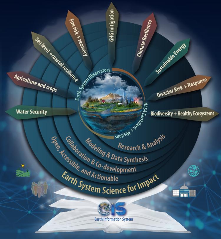
EIS is composed of a diverse team of more than 100 scientists and data experts across NASA centers and partner universities who collaborate to address high-priority topics identified in NASA’s Earth Action Strategy: Water Security, Fire, Sea Level Change and Coastal Risk, Greenhouse Gases, and Agriculture. A few highlights of EIS activities are described below.
Water Security
EIS is quantifying surface and groundwater, human management influence, hydrological extremes, and forecasts by blending NASA models and remote sensing data. EIS will continue to quantify changes in the global water cycle while identifying connections between hydrological extremes, human and aquatic health, and intersection of water-energy applications.
Fire
EIS recognizes the global scope of fire and the diverse impacts of fire on the Earth system. With scientific expertise across the entire fire lifecycle, EIS thrives by improving estimates of future fire risk and fire emissions as well as monitoring global post-fire impact by developing a global fire tracking dashboard.
Sea Level Change and Coastal Risk
EIS is implementing a suite of existing Earth system models on cloud computing and analysis environments to support research and analysis being done across a range of NASA programs, such as the NASA Sea Level Change Team (N-SLCT) and the Coastal Resilience program. EIS is working to reduce uncertainties in components contributing to the sea-level change, developing tools to advance monitoring and analysis capabilities for regional coastal sea level change, and improving our understanding of human impacts on coastal flood risks.
Greenhouse Gases
EIS played a critical role in integrating expertise needed to support a wide variety of tools to characterize greenhouse gas (GHG) concentrations and fluxes, and worked to further advance the most mature tools that can be integrated to support monitoring and mitigating human GHG emissions. The focus of EIS is to understand GHGs as part of the broader carbon cycle, which is one of the pillars of the Earth system.
Agriculture
Activities within EIS aim to bridge information gaps and address additional risk and uncertainty for agricultural producers working to minimize inputs and sustain crop yields and farm revenue in the face of the emerging impacts of climate change. EIS will explore quantification and predictability of water availability for agriculture, extreme events impact on agriculture, yield forecast, and impact of the air-water-soil intersection on agriculture.


