Delivery of Suomi National Polar-orbiting Partnership (Suomi NPP) satellite data products will cease on November 1, 2026. Data users should transition now to alternative products from NOAA-21 and NOAA-20.
Suomi NPP data announcement
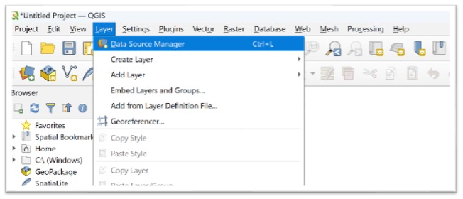
- Launch QGIS
- Open 'Layer'
- Click 'Data Source Manager' (or use the shortcut icon on the toolbar)
Image
Step 2 - Create New Connection
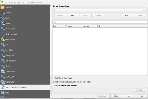
- Select WFS / OGC API – Features (from the source manager list on the left)
- Click on 'New' to create new connection
Image
Step 3 - Specify Connection Parameters
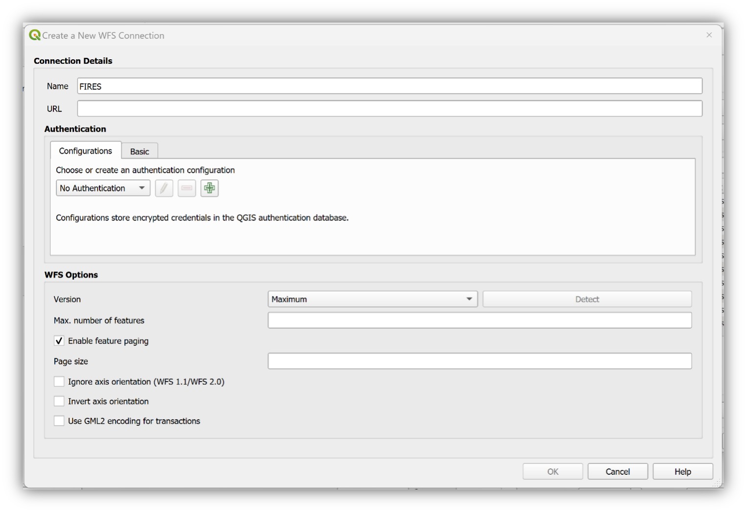
- Name: Enter a name for the new connection
- For server URL set:
https://firms.modaps.eosdis.nasa.gov/mapserver/wfs/[LAYER_TYPE]/<YOUR_MAP_KEY>/[LAYER_TYPE]is the geographic region of interest (review the GetCapabilities list here)<YOUR_MAP_KEY>is a unique code containing both letters and numbers; you can request a free Map Key here: https://firms.modaps.eosdis.nasa.gov/mapserver/wfs-info/#firms-mapkey- For example - for the WFS for the contiguous USA and Hawaii, you would insert:
https://firms.modaps.eosdis.nasa.gov/mapserver/wfs/USA_contiguous_and_Hawaii/<YOUR_MAP_KEY>/ - If successful, this would list the MODIS & VIIRS (including S-NPP, NOAA-20, NOAA-21) Fire / Hotspots for the last 24 hours and last 7 days.
- Click on OK.
Image
Step 4 - Select FIRMS Layer
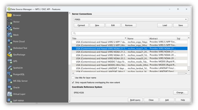
- Click on 'Connect' to get the list of available FIRMS layers
- Choose layer(s) of interest
- Click on 'Add'
Image
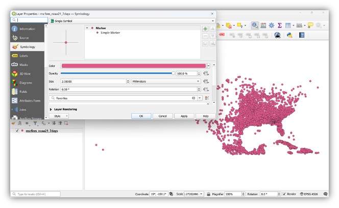
Step 5 - Customize Color and Attributes
- Open Layer Properties
- Select 'Symbology'
Image
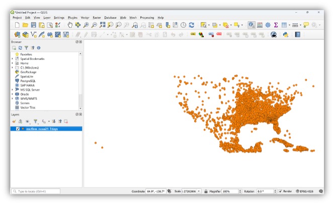
Step 6 - View Results
- The map will display custom symbology
Image
Details
Last Updated
Published
Nov. 12, 2019