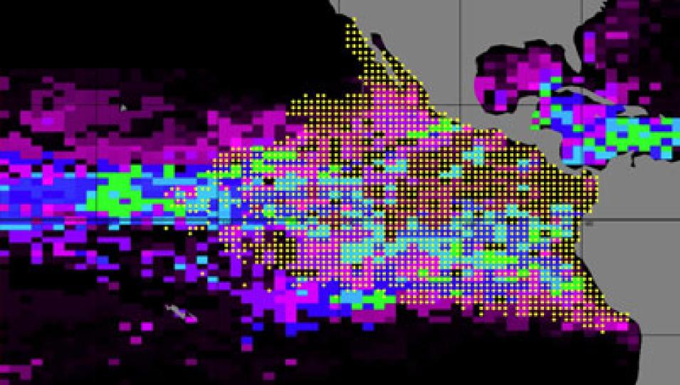
Kiefer was still unsure about the dependability of the fishing logbook data. He said, “The most frustrating challenge is to take these data, which are governed by strategies and decisions made by fishermen, and to turn them into sound information about the fish’s location, distribution, and habitat.” Scientific studies are traditionally based on random sampling or a fixed array. “Getting information from a biased party is not the way scientists do things,” Kiefer said.
Kiefer’s colleague, environmental studies professor D. G. Webster, saw this weakness as an opportunity to learn more about the fish and its pursuers. Kiefer said, “She wanted to put the mind of the fisherman right in the software.” Webster is taking PHAM and integrating it onto another software called Fishscape, an ambitious effort to create a four-dimensional mathematical model of the entire fishery in the eastern Pacific Ocean—from the fish in the water, to the regulations made by fisheries managers, to the skippers and their fleets. Webster said, “We will use PHAM to combine data on the ocean with Fishscape’s data on the fishers, the markets, and even the political policies to fully understand the dynamics of a fish stock’s resilience or its collapse.”
Virtual fishermen
Fishscape is a little like SimCity, a simulation game where the city’s residents react to changes in the environment introduced by the game’s player. Like SimCity, Fishscape will be populated by residents—in this case, virtual fishermen. Webster interviewed dozens of fishermen to model how they behave in different situations. She is using this information to create virtual fishers who will fish in the simulation using real environmental and fish fleet data from PHAM. “We want to find out if there are behaviors of the fishermen that allow them to keep catching fish, even though there aren’t many fish out there,” Webster said.
Although it uses computer modeling that borrows elements from game theory, Webster does not want Fishcape to be taken lightly. “We’re not going to have cute little avatars going out on virtual fishing boats, selling fish in virtual markets with prices that have no relationship with supply or demand,” she said. When Fishscape is completed in 2013, Webster will test and study three scenarios. “We want to know how climate change, an increase in the price of oil, and further technological improvements in the fishing fleets could impact the sustainability of fisheries—that is, the ability of the fish, the fishers, and fish consumers to thrive now and in the future,” she said.
Webster is optimistic that Fishscape can shed light on the relationship between ocean currents, food availability, and fishes’ reproductive success. More importantly, it could help prevent the eastern Pacific tuna and other fish stocks from crashing like the North Atlantic cod. “It will break down barriers to cooperation by moving the focus away from conflict over who gets what—and the related inability to prevent the decline of stocks—to agreement on management that can improve conditions for everyone, even the fish,” she said.
References
Armstrong E., D. Kiefer, F. O’Brien, D. P. Harrison, M. Hinton, S. Kohin, and S. Snyder. 2009. The Pelagic Habitat Analysis Module (PHAM): Decision support tools for pelagic fisheries. Eos Transactions of the American Geophysical Union 90(52).
Webster, D.G. 2011. The irony and the exclusivity of Atlantic bluefin tuna management. Marine Policy 35: 249–251. doi:10.1016/j.marpol.2010.08.004
For more information
NASA Ocean Biology Distributed Active Archive Center (OB.DAAC)
NASA Physical Oceanography DAAC (PO.DAAC)
Moderate Resolution Imaging Spectroradiometer (MODIS)
Sea-Viewing Wide Field-of-View Sensor (SeaWiFS)
Dale Kiefer
D. G. Webster
Pelagic Habitat Analysis Module
Fishscape
Inter-American Tropical Tuna Commission (IATTC)
| About the remote sensing data used |
| Satellites | Terra and Aqua | OrbView-2 (SeaStar) |
| Sensors | Moderate Resolution Imaging Spectroradiometer (MODIS) | Sea-Viewing Wide Field-of-view Sensor (SeaWiFS) |
| Data sets | GHRSST Sea Surface Temperature | SeaWiFS Daily Chlorophyll Data |
| Resolution | 0.25 degree | 4 kilometer, 9 kilometer |
| Parameters | Sea surface temperature | Ocean color |
| DAACs | NASA Physical Oceanography Distributed Active Archive Center (PO.DAAC) | NASA Ocean Biology DAAC (OB.DAAC) |
A tuna boat uses a purse seine net to surround a school of tuna in the eastern Pacific Ocean. The net is drawn closed at the bottom, like a purse, to prevent the fish from escaping. (Photograph by C. Orange courtesy NOAA Photo Library)


