Earthdata Forum is down due to unplanned maintenance. Please contact earthdata-support@nasa.gov with questions.
See the alert
Smoke from fires in western USA
Image captured on 29 July 2018, by the MODIS instrument, aboard the Terra satellite.
Image
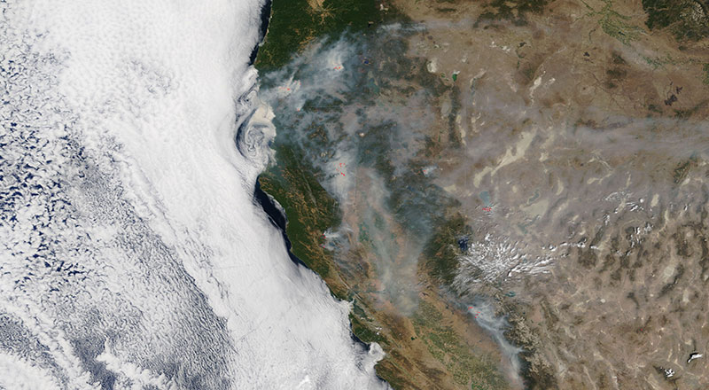
Image of smoke from fires in the western US states of Oregon, California and Nevada on 29 July 2018. This true color corrected reflectance image was captured by the Moderate Resolution Imaging Spectroradiometer (MODIS) aboard the Terra satellite.
View an animation of these fires from July 18 - 29.
Visit Worldview to visualize near real-time (NRT) data from NASA's Earth Observing System Data and Information System (EOSDIS).
Details
Last Updated
Published on
Feb. 26, 2020