Delivery of Suomi National Polar-orbiting Partnership (Suomi NPP) satellite data products will cease on November 1, 2026. Data users should transition now to alternative products from NOAA-21 and NOAA-20.
Suomi NPP data announcement
Tropical Storms Beta and Teddy
Image captured on 20 September 2020, by the VIIRS instrument, aboard the joint NASA/NOAA Suomi NPP satellite.
Image
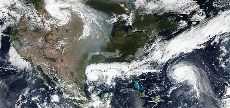
Image of Tropical Storms Beta and Teddy, acquired on 20 September 2020. Tropical Storm Beta is in the center of the image, approaching the Texas coast and Tropical Storm Teddy is to the right, approaching Bermuda in the Atlantic Ocean. Smoke from the Western US fires is also visible over the Midwest. The photo-like, true color corrected reflectance image was captured by the Visible Infrared Imaging Radiometer Suite (VIIRS), also aboard Suomi NPP satellite.
Visit Worldview to visualize near real-time imagery from NASA's EOSDIS, and check out more Worldview weekly images in our archive.
Details
Last Updated
Published on
Sept. 28, 2020