We are in the process of migrating all NASA Earth science data sites into Earthdata from now until end of 2026. Not all NASA Earth science data and resources will appear here until then. Thank you for your patience as we make this transition.
Read about the Web Unification Project
Cryosphere Learning Resources
Webinars, tutorials, data recipes and more to help you work with Cryosphere.
Filters
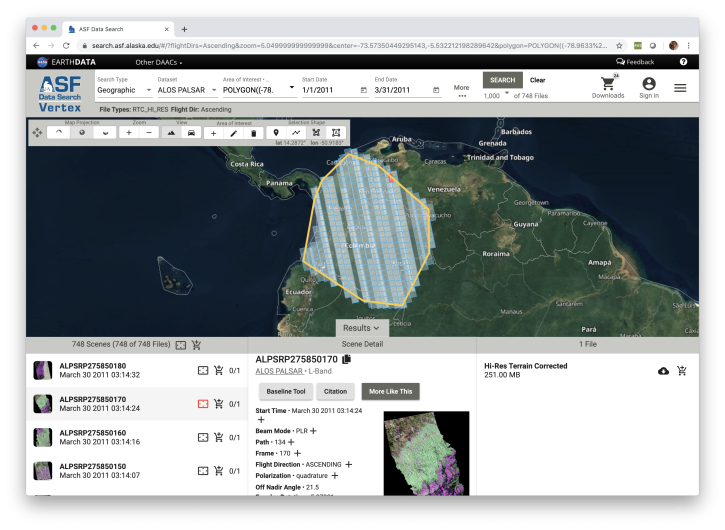
Learn how to discover, access and manipulate SAR data with the newly revamped NASA ASF DAAC Vertex tool. We'll showcase common data access methods and some of the advanced features of this data discovery and data access tool.
Webinar
Nov. 4, 2020

During this webinar we will introduce several of the NSIDC DAAC snow-focused NASA missions and data products, followed by a live demonstration teaching participants how to discover, access, and couple snow data across varying geospatial scales using Python.
Webinar
Nov. 4, 2020
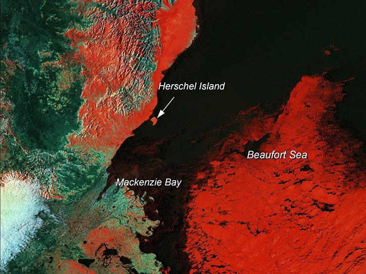
Learn how scientists use remote sensing data to study sea ice patterns to see how changes can influence weather, climate, and animal populations in these regions.
Data in Action
Dec. 6, 2018
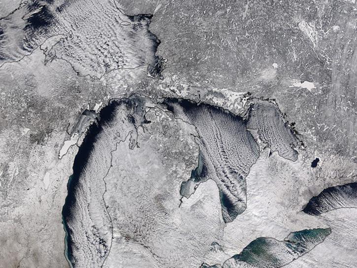
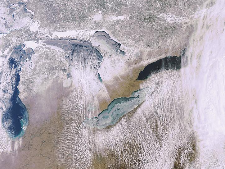
Studying the mechanics of lake effect snow helps researchers better understand water/land contrasts across snowfall bands.
Data in Action
Oct. 19, 2018
What is the 3D structure of falling snow and how does its variability affect remotely sensed retrievals?
Data in Action
Oct. 19, 2018

Learn how the Oceans Melting Greenland (OMG) projects surveys Greenland’s glaciers and ice sheets and studies how the oceans and ice interact with each other.
Data in Action
Feb. 27, 2017

Satellite data from NASA's MODIS instrument illustrates the relationship between snow cover and temperature and the viability of skiing conditions over time.
Data in Action
Feb. 2, 2017

The Global Land Ice Measurements from Space (GLIMS) initiative uses satellite data to track glacier changes, providing vital data for climate and hazard studies.
Data in Action
Dec. 14, 2016
SHOWING 8 OF 50
Frequently Asked Questions
Earthdata Forum
Our online forum provides a space for users to browse thousands of FAQs about research needs, data, and data applications. You can also submit new questions for our experts to answer.
Submit Questions to Earthdata Forumand View Expert Responses