We are in the process of migrating all NASA Earth science data sites into Earthdata from now until end of 2026. Not all NASA Earth science data and resources will appear here until then. Thank you for your patience as we make this transition.
Read about the Web Unification Project
Infrastructure News
Articles, resources, and announcements from Infrastructure.

Image captured on February 17, 2026, by the C-Band SAR instrument aboard ESA's Sentinel-1C platform.
Worldview Image of the Week
Feb. 27, 2026

Image captured January 21, 2026, by the VIIRS instrument aboard the joint NASA/NOAA Suomi NPP platform.
Worldview Image of the Week
Jan. 22, 2026

PRUVE is built on open-source frameworks to make assessing data uncertainty more accessible.
Blog
Dec. 17, 2025

Harmonized Landsat and Sentinel-2 (HLS) image captured on November 9, 2025, by the MSI instrument aboard the Sentinel-2B platform.
Worldview Image of the Week
Nov. 20, 2025

Image captured November 13, 2025, by the VIIRS instrument aboard the joint NASA/NOAA NOAA-21 platform.
Worldview Image of the Week
Nov. 13, 2025

This image was captured on August 14, 2025, by the VIIRS instrument aboard the joint NASA/NOAA NOAA-20 platform.
Worldview Image of the Week
Aug. 14, 2025
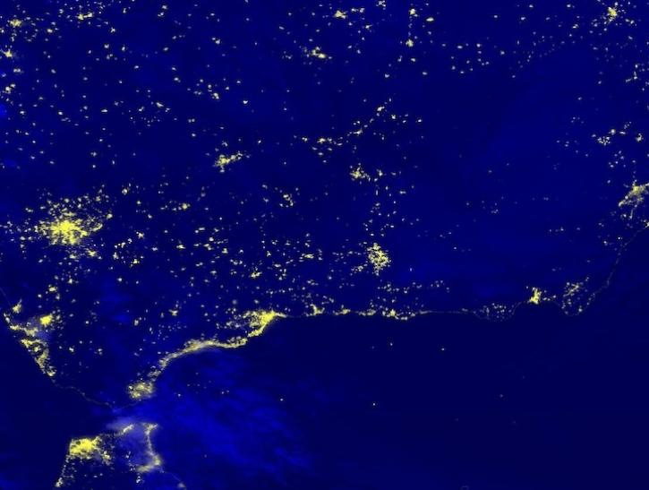
Image captured April 29, 2025, by the VIIRS instrument aboard the joint NASA/NOAA NOAA-20 platform.
Worldview Image of the Week
May 1, 2025
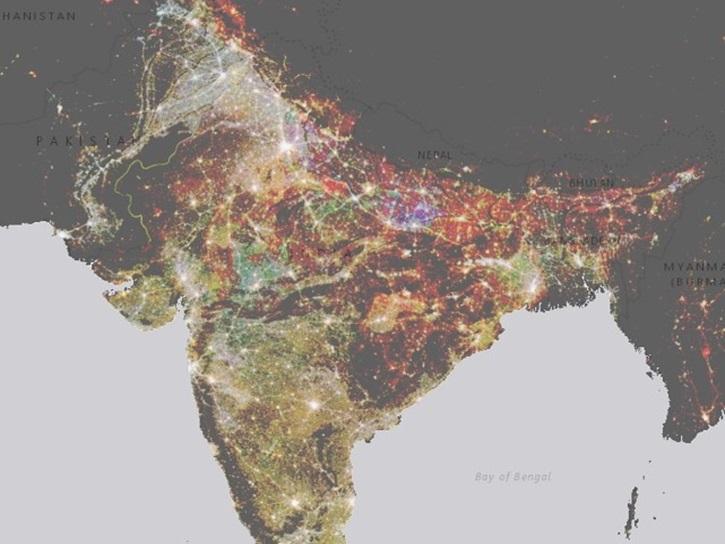
NASA’s Socioeconomic Data and Applications Center (SEDAC) has released a collection of 12 datasets focused on the urban environment.
Feature Article
Feb. 7, 2025
SHOWING 8 OF 27