We are in the process of migrating all NASA Earth science data sites into Earthdata from now until end of 2026. Not all NASA Earth science data and resources will appear here until then. Thank you for your patience as we make this transition.
Read about the Web Unification Project
Land Subsidence News
Articles, resources, and announcements from Land Subsidence.
Users can now generate on-demand interferograms for more than a million ARIA-S1-GUNW products.
News
Nov. 14, 2025
When the Arizona Department of Water Resources lost valuable synthetic aperture radar (SAR) data, OpenSARLab provided a solution.
Feature Article
Oct. 18, 2022

Data from NASA’s ASF DAAC helps scientists like Dr. Zhong Lu develop satellite radar remote-sensing techniques for studying geohazards.
Data User Story
July 28, 2022

Who Uses NASA Earth Science Data? Rowena Lohman, to study earthquake physics, satellite remote sensing, finite element modeling, ground displacements from a variety of anthropogenic and natural causes.
Data User Story
April 22, 2021
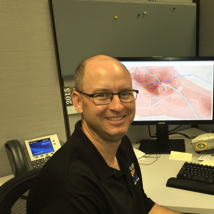
Who uses NASA Earth science data? Brian Conway, to monitor land subsidence and the impacts of this on Arizona’s water resources.
Data User Story
Dec. 21, 2020

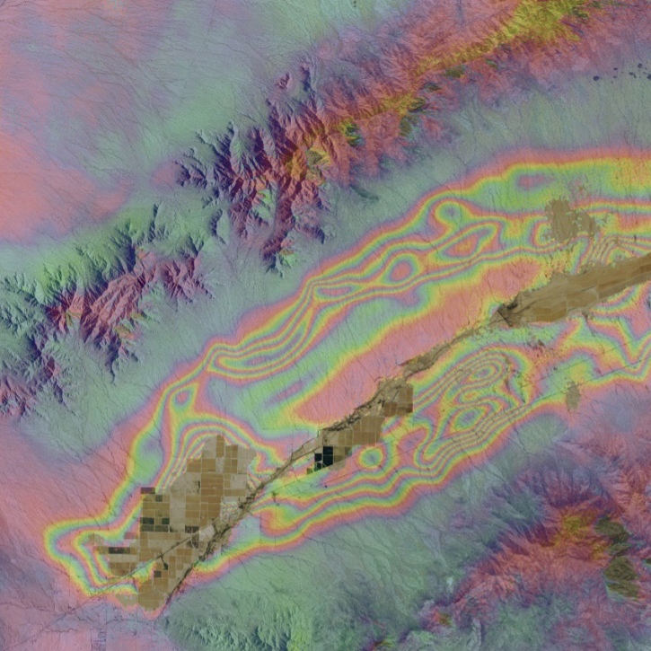
Colored bands in an interferogram show the gradual sinking of land (subsidence) in Arizona’s McMullen Valley Groundwater Basin between April 2010 and May 2015.
Feature Article
Nov. 4, 2020

In October 2001, a volcano in the remote South Sandwich Islands began spewing ash and lava. Less than 24 hours after the eruption began, a research team nearly 9,000 miles away was estimating how much energy the volcano was producing.
Feature Article
July 28, 2020
SHOWING 7 OF 7