We are in the process of migrating all NASA Earth science data sites into Earthdata from now until end of 2026. Not all NASA Earth science data and resources will appear here until then. Thank you for your patience as we make this transition.
Read about the Web Unification Project
Terrestrial Hydrosphere Learning Resources
Webinars, tutorials, data recipes and more to help you work with Terrestrial Hydrosphere.
Filters
This ARSET training focuses on introducing SWOT freshwater data products and their applications for water resources and disaster management.
Training
May 13-15, 2025
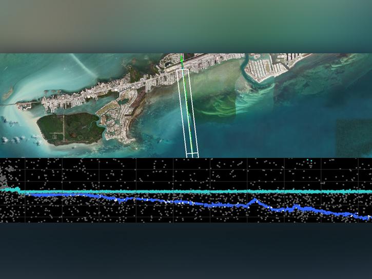
In the third webinar of the ICESat-2 series, learn how to discover, access, and work with a new bathymetric data product, ATL24.
Webinar
March 24, 2025

Learn more about the NASA Commercial Satellite Data Acquisition (CSDA) program vendor Capella Space and how to discover, access, and work with their SAR data products.
Webinar
Dec. 30, 2024

When natural disasters occur, NASA's Disaster Response Coordination System works to deliver data to stakeholders that can be used to guide decision-making.
Data in Action
Nov. 8, 2024
Learn about the water masking option provided by NASA’s Alaska Satellite Facility Distributed Active Archive Center (ASF DAAC) for on-demand Sentinel-1 interferometric synthetic aperture radar (InSAR).
StoryMap
Aug. 23, 2024

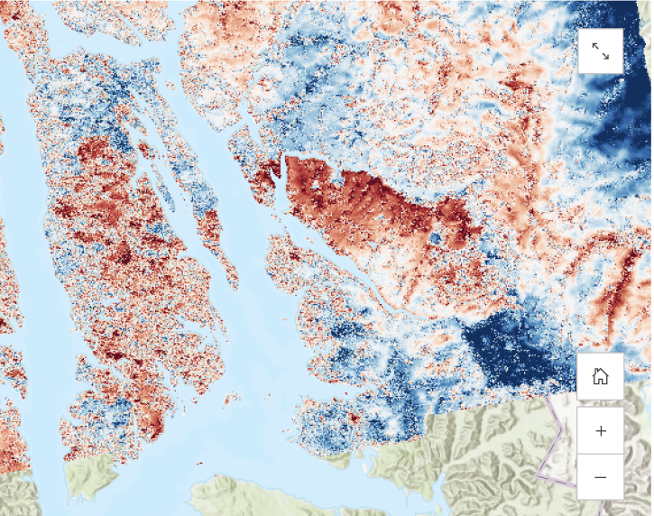
Earth observation data help scientists accurately measure changes to Earth's month-to-month mass and the estimated amount of water beneath its surface.
Data in Action
Aug. 13, 2024

Due to unforeseen circumstances, this webinar is postponed and will be rescheduled soon. We apologize for the short notice and appreciate your continued interest and support. We look forward to your attendance at our rescheduled webinar, to be announced.
Webinar
June 26, 2024
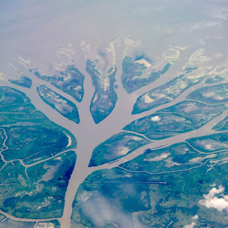
This webinar presents an overview of NASA's Delta-X mission and data, including demonstrations for finding, accessing, and working with Delta-X datasets using tools, services, and Jupyter Notebooks.
Webinar
June 7, 2024
SHOWING 8 OF 83
Frequently Asked Questions
Earthdata Forum
Our online forum provides a space for users to browse thousands of FAQs about research needs, data, and data applications. You can also submit new questions for our experts to answer.
Submit Questions to Earthdata Forumand View Expert Responses