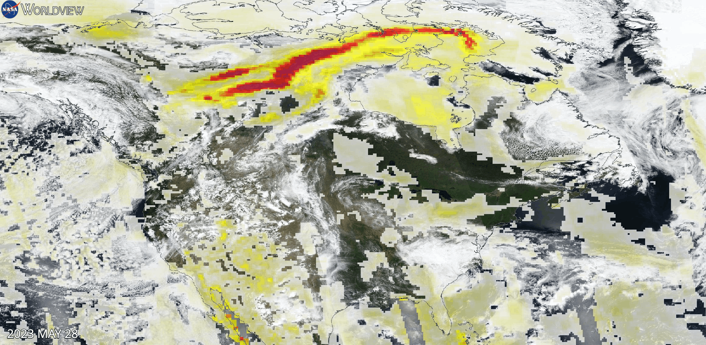
Animation spanning May 28 to June 7, 2023, showing high Aerosol Index values due to wildfires raging across Canada. The base true-color corrected reflectance images were acquired by the Visible Infrared Imaging Radiometer Suite (VIIRS) aboard the joint NASA/NOAA Suomi National Polar-orbiting Partnership (Suomi NPP) satellite.
Overlaid on the base images is the Aerosol Index layer from the Ozone Mapping and Profiler Suite (OMPS) instrument. This layer indicates the presence of ultraviolet (UV)-absorbing particles in the atmosphere (aerosols) such as desert dust and soot; it is related to both the thickness of the aerosol layer located in the atmosphere and to the height of the layer.
The Aerosol Index is a unitless value that ranges from < 0 to >= 5, where 5 (shown in dark red) indicates heavy concentrations of aerosols that could reduce visibility or impact human health, such as dust storms or smoke in the lower troposphere (1-3 km above Earth's surface) from biomass burning. Press play to view the animation of high Aerosol Index over Canada in Worldview.
Visit Worldview to visualize near real-time imagery from NASA's EOSDIS; find more in our Worldview weekly image archive.