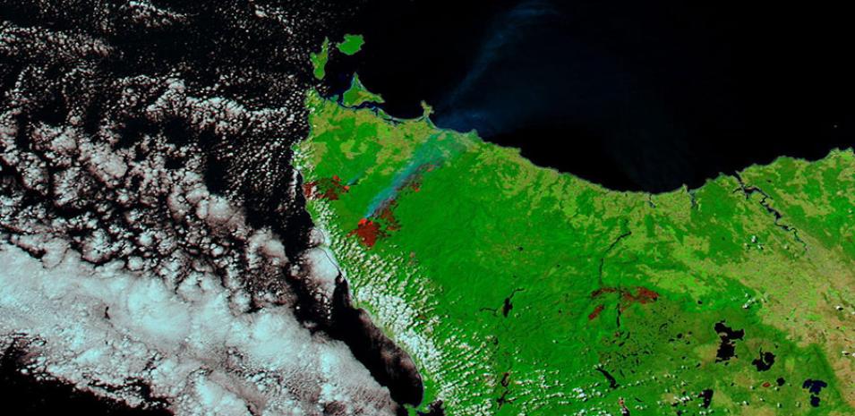
Image of bushfires in Tasmania acquired on 8 February 2016 by the Moderate Resolution Imaging Spectroradiometer (MODIS) sensor aboard the Aqua satellite. This image is a 7-2-1 band combination. If vegetation burns, bare soil in the area will become exposed. Band 1 slightly increases usually, but that may be offset by the presence of black carbon residue. The near infrared (Band 2) will become darker, and Band 7 becomes more reflective. When assigned to red in the image, Band 7 will show burn scars as deep or bright red, depending on the type of vegetation burned, the amount of residue, or the completeness of the burn.
The larger burned area on the right is the Pipeline Road, Mawbanna burned area and the smaller burned area on the left is the Wuthering Heights Road, Temma burned area.
Visit Worldview to visualize near real-time data from NASA's Earth Observing System Data and Information System (EOSDIS).
Sources: Tasmania Fire Service
