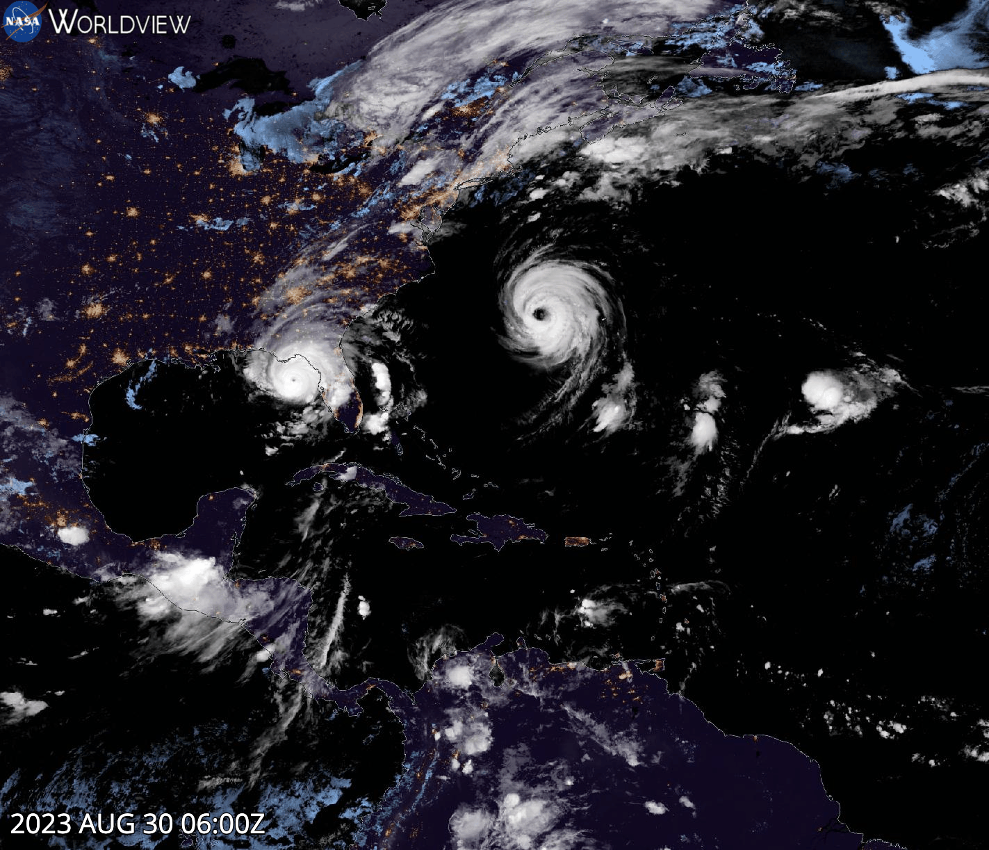
GeoColor hourly animation of Hurricane Idalia (seen as it moves across the state of Florida) and Hurricane Franklin (spinning in the Atlantic Ocean near Bermuda) starting on August 30 at 2:00 a.m., EDT (06:00 UTC) and ending on August 31 at 12:00 a.m., EDT (04:00 UTC). The imagery was captured by the Advanced Baseline Imager (ABI) instrument aboard the GOES-East (GOES-16) satellite.
Hurricane Idalia made landfall Wednesday morning, August 30, over Keaton Beach near Tallahassee, the Florida state capital, as a Category 3 hurricane with maximum sustained winds of 145 mph. To the east, Hurricane Franklin brought gusty winds to Bermuda and was a strong Category 4 hurricane on Monday, August 28, with winds as high as 150 mph before weakening to a Category 1 hurricane by Thursday, August 31. Visit Worldview to see the animation of Hurricane Idalia making landfall along Florida's Gulf Coast and Hurricane Franklin in the Atlantic Ocean.
The GeoColor (PDF) image consists of true color imagery for day and multispectral blended infrared (IR) imagery for night. At night, the true color imagery gives way to IR-based blended multispectral imagery that provides differentiation between low liquid water clouds (shown in light blue) and higher ice clouds (shown in gray/white). It also includes a static city lights/nighttime lights database derived from the Visible Infrared Imaging Radiometer Suite (VIIRS) Day/Night Band, which aids in geo-referencing and can help determine the proximity of clouds (such as fog) or weather hazards (such as thunderstorms or tropical cyclones) to population centers. Please note that as these lights are static, they will not change even if, for example, a weather-induced power outage occurs.
Visit Worldview to visualize near real-time imagery from NASA's EOSDIS; find more imagery in our Worldview weekly image archive.