Earthdata Forum is down due to unplanned maintenance. Please contact earthdata-support@nasa.gov with questions.
See the alert
Typhoon Maysak
Image captured on 31 August 2020, by the VIIRS instrument, aboard the joint NASA/NOAA Suomi NPP satellite.
Image
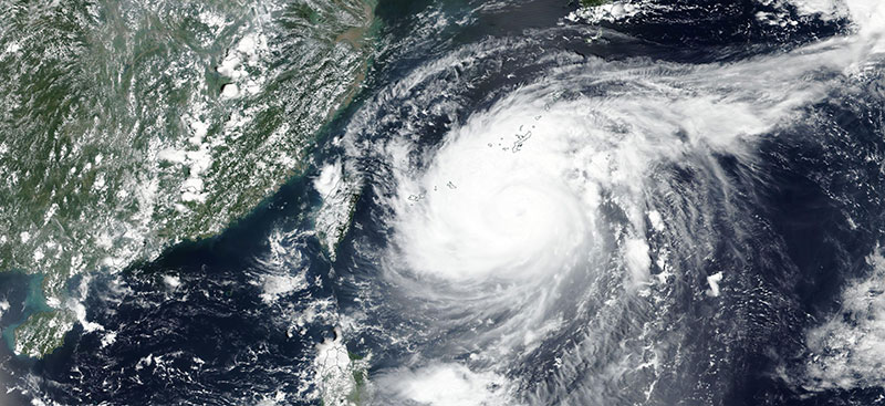
Image of Typhoon Maysak moving towards southern Japan's Ryukyu Islands, acquired on 31 August 2020. The photo-like, true color corrected reflectance image was captured by the Visible Infrared Imaging Radiometer Suite (VIIRS) aboard the joint NASA/NOAA Suomi National Polar-orbiting Partnership (Suomi NPP) satellite.
Visit Worldview to visualize near real-time imagery from NASA's EOSDIS, and check out more Worldview weekly images in our archive.
Details
Last Updated
Published on
Sept. 8, 2020