We are in the process of migrating all NASA Earth science data sites into Earthdata from now until end of 2026. Not all NASA Earth science data and resources will appear here until then. Thank you for your patience as we make this transition.
Read about the Web Unification Project
A DSWx-S1 processing issue that combined Sentinel-1A and -1C data into a single product was fixed on Dec. 9, 2025. Affected products are being reprocessed, with completion expected by January 2026.
Learn more.
PO.DAAC News
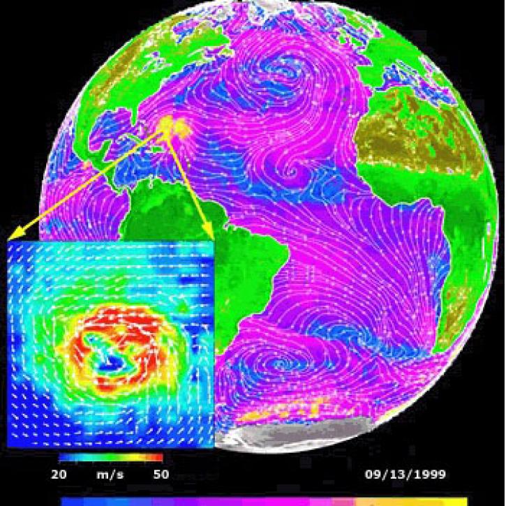
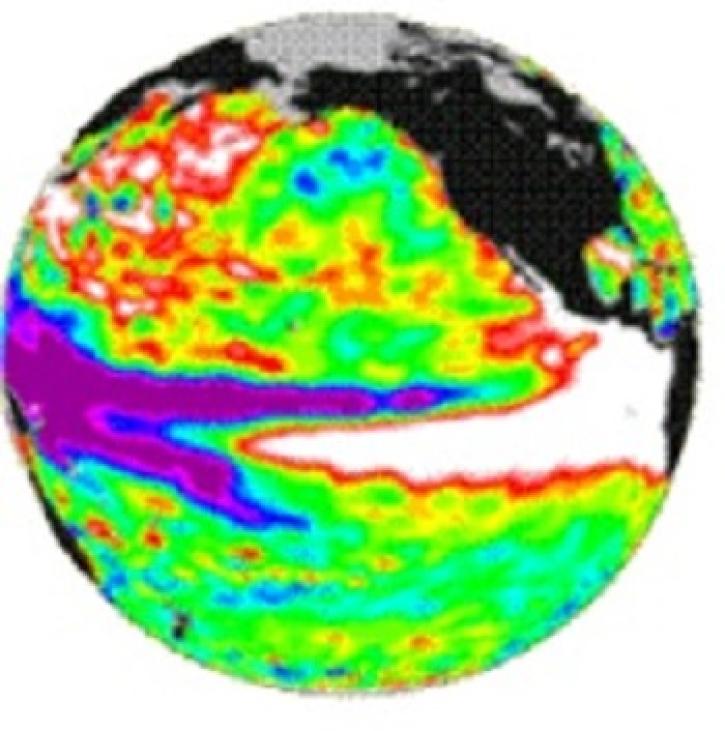
Read the latest news stories, feature articles, user stories, and blog posts that feature data archived by NASA's Physical Oceanography Distributed Active Archive Center (PO.DAAC).
For real-time announcements about data outages, releases, and retirements, see our list of Data Alerts and Outages.
Filters
QuikSCAT and TOPEX help scientists notice the long wake near Hawaii.
Feature Article
July 22, 2020
Canadian RADARSAT data is used to indicate the presence of open water in polar ice.
Feature Article
July 22, 2020
Data from NASA satellites allow researchers to detect potential hurricanes up to two days earlier than with traditional forecasting methods.
Feature Article
July 22, 2020
TOPEX/Poseidon measured the gradual build-up of warm water in the easter equatorial Pacific.
Feature Article
July 22, 2020
An ocean general circulation model produces sea level and temperature responses to four separate events.
Feature Article
July 21, 2020
The TOPEX and Poseidon satellites monitor ocean surface topography.
Feature Article
July 21, 2020
The Distributed Oceanographic Data System (DODS) uses the internet to find and obtain oceanographic data.
Feature Article
July 21, 2020
Assimilation of TOPEX/Poseidon data into a model of the North Atlantic.
Feature Article
July 21, 2020
Pagination
SHOWING 8 OF 166