Delivery of new Suomi NPP data ceases on Nov. 2, 2026. Users should transition to alternative products.Suomi NPP data announcement
Migration to Consolidated Ingest and Archive will interrupt data ingestion at PO.DAAC, ASF DAAC, and GES DISC on Oct. 28-30, 2026.Read more
Description
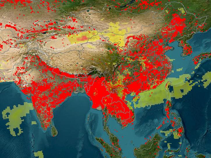
Near real-time (NRT) Suomi National Polar-orbiting Partnership (Suomi NPP) Visible Infrared Imaging Radiometer Suite (VIIRS) Active Fire detection product is based on that instrument's 375 m nominal resolution data. Compared to other coarser resolution (≥1km) satellite fire detection products, the improved 375 m data provide greater response over fires of relatively small areas, as well as improved mapping of large fire perimeters. Consequently, the data are well suited for use in support of fire management (e.g., near real-time alert systems), as well as other science applications requiring improved fire mapping fidelity. The 375 m product complements the baseline Suomi NPP/VIIRS 750 m active fire detection and characterization data, which was originally designed to provide continuity to the existing 1 km Earth Observing System Moderate Resolution Imaging Spectroradiometer (EOS/MODIS) active fire data record. Due to frequent data saturation issues, the current 375 m fire product provides detection information only with no sub-pixel fire characterization.
VNP14IMGTDL_NRT are available through NASA FIRMS in the following formats: TXT, SHP, KML, WMS. These data are also provided through the LANCE FIRMS Fire Email Alerts. Please note only the TXT and SHP files contain all the attributes.
Land, Atmosphere Near real-time Capability for EOS (LANCE) Moderate Resolution Imaging Spectroradiometer (MODIS) Fire Information for Resource Management System (FIRMS) (NASA/GSFC/EOS/ESDIS/LANCE MODIS FIRMS)
We provide information on what this change means for your workflows and the recommended replacement datasets you can use in FIRMS to ensure uninterrupted fire monitoring.
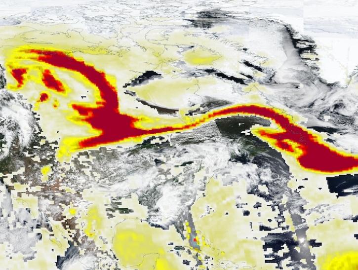
Image captured May 29, 2025, by the VIIRS and OMPS instruments aboard the joint NASA/NOAA Suomi NPP platform.
Worldview Image of the Week
May 30, 2025
SHOWING5 OF 5
Get Help
QUESTIONS & SUPPORT
Have a question?
Get help with NASA Earth science data, datasets, tools, services, and metadata on the Earthdata Forum. Experienced staff in the data user community review and answer questions.
Miech, Jason A., DiGangi, Joshua P., Diskin, Glenn S., Choi, Yonghoon, Moore, Richard H., Ziemba, Luke D., Gallo, Francesca, Jordan, Carolyn E., Shook, Michael A., Wiggins, Elizabeth B., Winstead, Edward L., Roy, Sayantee, Lee, Young Ro, Ball, Katherine, Crounse, John D., Wennberg, Paul, Piel, Felix, Swift, Stefan, Wojnowski, Wojciech, Wisthaler, Armin
DiGangi, Joshua P., Diskin, Glenn S., Yoon, Subin, Alvarez, Sergio L., Flynn, James H., Robinson, Claire E., Shook, Michael A., Thornhill, K. Lee, Winstead, Edward L., Ziemba, Luke D., Cambaliza, Maria Obiminda L., Simpas, James B., Hilario, Miguel Ricardo A., Sorooshian, Armin
Barber, Quinn E., Jain, Piyush, Whitman, Ellen, Thompson, Dan K., Guindon, Luc, Parks, Sean A., Wang, Xianli, Hethcoat, Matthew G., Parisien, Marc-Andre