We are in the process of migrating all NASA Earth science data sites into Earthdata from now until end of 2026. Not all NASA Earth science data and resources will appear here until then. Thank you for your patience as we make this transition.
Read about the Web Unification Project
MODIS Resources
Earthdata resources for users working with NASA’s Moderate Resolution Imaging Spectroradiometer (MODIS) data include tutorials and other learning resources, news announcements such as instrument updates and data releases, user guides and related documents, and frequently asked questions.
MODIS Learning Resources

Learn now NASA's Soil Moisture Active Passive (SMAP) satellite and other satellite instruments were used to create a comprehensive chronology of the flood from land to ocean.
Data in Action
Dec. 6, 2016

Discover how a NASA DEVELOP team developed a tool to understand drought impact and avoid long-term effects.
Data in Action
Nov. 30, 2016

Learn how to access and use Moderate Resolution Imaging Spectroradiometer (MODIS) Version 6 land data.
Webinar
Nov. 22, 2016

This visualization shows 34 years of Earth's seasonal vegetation changes, driven by its orbit and tilt, using NASA's MEaSUREs Vegetation Index and Phenology (VIP) Version 4 collection.
Tutorial
Nov. 22, 2016

Explore the stunning autumn foliage in Eastern Asia from space with NASA remote sensing data.
Data in Action
Nov. 9, 2016

Learn how satellite data supported landslide detection in the French Alps, flowering pattern analysis for beekeepers, and mangrove ecosystem monitoring in Bangladesh and India.
Data in Action
Oct. 29, 2016

View LP DAAC's presentation at the Black Hills Digital Mapping Association's 2016 annual conference.
Webinar
Oct. 4, 2016

This ARSET training covers NASA soil moisture and evapotranspiration products and how to access and apply them for water resource management.
Training
Sept. 1-29, 2016
SHOWING 8 OF 218
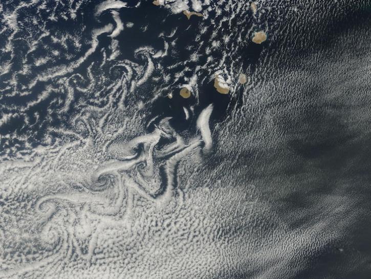
Image captured on Mar 12, 2025, by the MODIS instrument aboard the Terra platform.
Worldview Image of the Week
March 13, 2025

Users of NASA’s Fire Information for Resource Management System (FIRMS) can now differentiate between fires caused by burning vegetation and fires from natural heat sources or industrial heat sources.
Blog
March 7, 2025
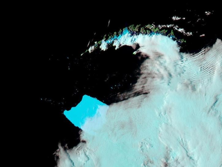
Image captured on Mar 4, 2025, by the MODIS instrument aboard the Aqua platform.
Worldview Image of the Week
March 6, 2025

A summary of datasets, products, and resources released by NASA’s Distributed Active Archive Centers (DAACs) in February 2025.
News
March 6, 2025
SHOWING 4 OF 409
Frequently Asked Questions
Earthdata Forum
Our online forum provides a space for users to browse thousands of FAQs about research needs, data, and data applications. You can also submit new questions for our experts to answer.
Submit Questions to Earthdata Forumand View Expert Responses