On May 6 from 8:00 to 9:00 a.m. (US Eastern Time), the Data Catalog and Earthdata Search search may be temporarily unavailable due to maintenance of the NASA Common Metadata Repository (CMR).
MODIS Resources
Earthdata resources for users working with NASA’s Moderate Resolution Imaging Spectroradiometer (MODIS) data include tutorials and other learning resources, news announcements such as instrument updates and data releases, user guides and related documents, and frequently asked questions.
MODIS Learning Resources

This visualization shows 34 years of Earth's seasonal vegetation changes, driven by its orbit and tilt, using NASA's MEaSUREs Vegetation Index and Phenology (VIP) Version 4 collection.
Tutorial
Nov. 22, 2016

Explore the stunning autumn foliage in Eastern Asia from space with NASA remote sensing data.
Data in Action
Nov. 9, 2016

Learn how satellite data supported landslide detection in the French Alps, flowering pattern analysis for beekeepers, and mangrove ecosystem monitoring in Bangladesh and India.
Data in Action
Oct. 29, 2016

View LP DAAC's presentation at the Black Hills Digital Mapping Association's 2016 annual conference.
Webinar
Oct. 4, 2016

This ARSET training covers NASA soil moisture and evapotranspiration products and how to access and apply them for water resource management.
Training
Sept. 1-29, 2016

Join us on at 2pm ET to learn about Arctic Boreal Vulnerability Experiment (ABoVE) Data Management Best Practices.
Webinar
Aug. 31, 2016

Read highlights of three publications that detail how NASA Earth observation data informs chickpea agriculture growth in India, harmful sediment plumes affecting Colombian coral reefs, and new gold sites in Egypt's Central Eastern Desert.
Data in Action
July 27, 2016

This ARSET training provides an overview of the remote sensing process, data products, and their use in air quality applications.
Training
July 6 - Aug. 3, 2016
SHOWING 8 OF 223

Image captured on 4 February 2019, by the MODIS instrument, aboard the Terra satellite.
Worldview Image of the Week
Sept. 11, 2020

Image captured by the MODIS instrument on 5 July 2015, aboard the Terra satellite
Worldview Image of the Week
Sept. 11, 2020

Image captured by the MODIS instrument, aboard the Terra satellite, on 23 August 2015.
Worldview Image of the Week
Sept. 11, 2020
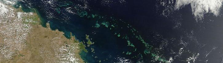
Image captured on 20 December 2015 by the MODIS instrument, aboard NASA's Terra satellite.
Worldview Image of the Week
Sept. 11, 2020
SHOWING 4 OF 527
Frequently Asked Questions
Earthdata Forum
Our online forum provides a space for users to browse thousands of FAQs about research needs, data, and data applications. You can also submit new questions for our experts to answer.
Submit Questions to Earthdata Forumand View Expert Responses