We are in the process of migrating all NASA Earth science data sites into Earthdata from now until end of 2026. Not all NASA Earth science data and resources will appear here until then. Thank you for your patience as we make this transition.
Read about the Web Unification Project
Suomi NPP Resources
Suomi NPP Learning Resources

Learn more about NASA's Application for Extracting and Exploring Analysis Ready Samples (AppEEARS). This webinar showcases the system's capabilities and highlights learning resources to help simplify data access workflows using AppEEARS.
Webinar
April 9, 2024

This ARSET training provides an overview and demonstration of the latest version of SeaDAS 8.4.1, which is useful for remote sensing of water quality.
Training
Feb. 13, 2024

This ARSET training covers the basics of natural hazard risk modeling and exposure development.
Training
Oct. 3-10, 2023
Esta capacitación de ARSET cubre los fundamentos de la modelación de riesgo de amenazas naturales y desarrollo de exposición.
Training
Oct. 3-10, 2023

Learn how to use NASA's Fire Information for Resource Management System (FIRMS) and its enhanced User Interface that provides additional services and analysis capabilities for wildfire management.
Webinar
Sept. 29, 2023

This training will cover how soil moisture is modeled within LIS in to improve drought monitoring.
Training
May 17-31, 2023

Join us April 26 at 2 p.m., EDT [UTC -4], to learn about NASA's LAADS DAAC data migration to the cloud and what this means for data users regarding schedule and data access. A live demo of Amazon Simple Storage Service (S3) direct access in the cloud will be provided.
Webinar
April 9, 2023

This ARSET training focuses on developments and updates in flood monitoring tools and flood modeling techniques.
Training
Sept. 14-21, 2022
SHOWING 8 OF 67
Suomi NPP News
View All News
Filters

Who uses NASA Earth science data? Dr. Sergio Signorini, to study the impact of climate variability on phytoplankton and Earth’s oceans.
Data User Story
April 22, 2021

Who uses NASA Earth science data? Dr. Emily Berndt, to improve short-term forecasts of high-impact weather.
Data User Story
April 22, 2021

Ocean color data provide key information about ocean health. Dr. Barnes uses these data in his investigations into the health of optically shallow waters.
Data User Story
April 22, 2021

This ArcGIS StoryMap highlights Data User Profiles, Learning Resources and Worldview imagery layers in support of Earth Day 2021.
Feature Article
April 19, 2021
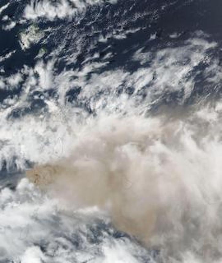
Image captured on 10 April 2021, by the VIIRS instrument, aboard the joint NASA/NOAA Suomi NPP satellite.
Worldview Image of the Week
April 19, 2021

NASA’s worldwide Fire Information for Resource Management System (FIRMS) provides vital near real-time tools for managing wildland fires.
Feature Article
April 15, 2021

A new Fire Information for Resource Management System (FIRMS) focused on the US and Canada provides expanded capabilities including additional map layers, ownership boundaries, and daily fire dangers.
News
April 13, 2021

Imagery of Earth at night provide unique opportunities for research. Dr. Miller uses these data in his studies of Earth’s nocturnal environment.
Data User Story
April 13, 2021
SHOWING 8 OF 333
Frequently Asked Questions
Earthdata Forum
Our online forum provides a space for users to browse thousands of FAQs about research needs, data, and data applications. You can also submit new questions for our experts to answer.
Submit Questions to Earthdata Forumand View Expert Responses