We are in the process of migrating all NASA Earth science data sites into Earthdata from now until end of 2026. Not all NASA Earth science data and resources will appear here until then. Thank you for your patience as we make this transition.
Read about the Web Unification Project
Terra Resources
Terra Learning Resources

This study analyzes 23,000 globally distributed wildfire smoke plume injection heights from MISR, stratified by region, biome, and month or season.
Data in Action
Oct. 10, 2018

Learn how scientists have used remote sensing data to support fish conservation in remote regions of Alaska.
Data in Action
Sept. 26, 2018

In Spring 2018, DEVELOP researchers used MODIS data to develop a mosquito tracking model to help prevent vector-borne diseases in Western Europe.
Data in Action
Aug. 29, 2018

This ARSET training focuses on areas of urban flooding that satellite data can track, including extreme precipitation and waterlogged and ponded surfaces.
Training
July 25 - Aug. 1, 2018

Remote sensing data's drought-indicating parameters are essential to manage the impact of water scarcities and minimize drought losses.
Data in Action
June 27, 2018

Learn how ASTER data are being used to study vegetation health and water in Africa.
Data in Action
May 23, 2018

This ARSET training covers the NASA data and tools useful for monitoring tropical storms.
Training
May 3-10, 2018

Discover how remote sensing data support water monitoring, wildfire risk modeling, and identification of optimal rainwater harvesting locations.
Data in Action
April 25, 2018
SHOWING 8 OF 235
Terra News
View All News
Filters

Image captured on 6 November 2016 by the MODIS instrument, aboard the Terra satellite.
Worldview Image of the Week
Nov. 7, 2016

Beginning July 20, 2016, NASA's LP DAAC users will need to use Earthdata login credentials to obtain data.
News
June 22, 2016

NASA's LP DAAC is now distributing Terra ASTER Level 1 Precision Terrain Corrected Registered At-Sensor Radiance data products worldwide.
News
April 1, 2016

Generation of Terra/MODIS atmospheric products has restarted as of April 8, 2016.
Blog
March 3, 2016

These products are available globally at their full resolution of 30 meters per pixel.
Blog
Dec. 9, 2015
Image captured by the MODIS instrument, aboard the Terra satellite, on 18 October 2015
Worldview Image of the Week
Oct. 20, 2015
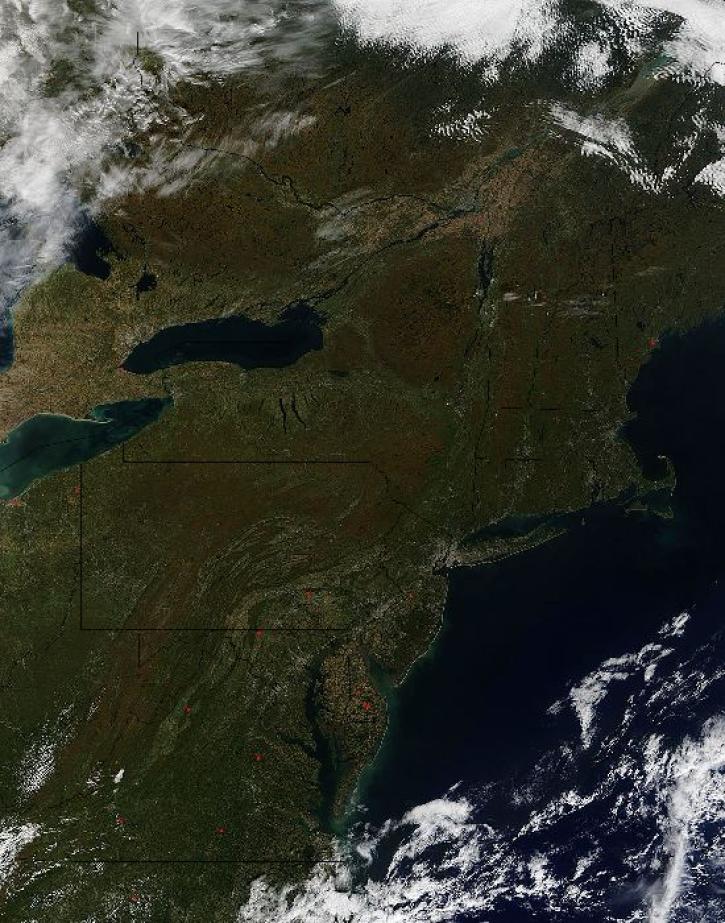
Image captured by the MODIS instrument, aboard the Terra satellite, on 12 October 2015 at 16:05 UTC.
Worldview Image of the Week
Oct. 15, 2015

Access Moderate Resolution Imaging Spectroradiometer (MODIS) Version 6 data starting in August 2015.
News
July 23, 2015
SHOWING 8 OF 450
Frequently Asked Questions
Earthdata Forum
Our online forum provides a space for users to browse thousands of FAQs about research needs, data, and data applications. You can also submit new questions for our experts to answer.
Submit Questions to Earthdata Forumand View Expert Responses