Alaska Satellite Facility DAAC (ASF DAAC)

Disciplines: Synthetic Aperture Radar (SAR)
Image
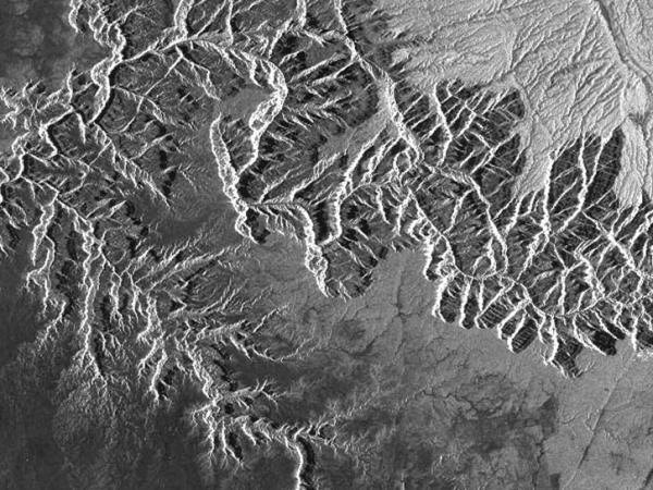
The above image is an ERS-2 view of the Alaska Peninsula and Augustine Volcano was part of the first ERS-2 data received at ASF. Credit: ESA

NASA's Alaska Satellite Facility Distributed Active Archive Center (ASF DAAC) is located in the Geophysical Institute at the University of Alaska, Fairbanks. ASF DAAC is supported by NASA to acquire, process, archive, and distribute synthetic aperture radar (SAR) data from polar-orbiting satellite and airborne sensors to advance Earth science research. Most of the datasets at ASF DAAC, including Copernicus Sentinel-1, are open access and freely available to the public for download.

Synthetic Aperture Radar (SAR) Data

ASF DAAC archives data from around the world. This includes data from the Copernicus Sentinel-1 constellation, Canadian RADARSAT-1, European Remote Sensing Satellite-2 (ERS-2), the Japanese ALOS PALSAR, European Remote Sensing Satellite-1 (ERS-1), Japanese Earth Resource Satellite-1 (JERS-1), and NASA's SMAP and Seasat satellites. In addition, ASF DAAC archives and distributes AirSAR and UAVSAR, two airborne SAR sensors operated by NASA.

Contact Information

Wade Albright, DAAC Manager
Kirk Hogenson, Deputy DAAC Manager
Dr. Franz Meyer, Chief Scientist

903 Koyukuk Drive
P.O. Box 757320
Fairbanks, AK 99775-7320

uso@asf.alaska.edu

https://asf.alaska.edu/

Last Updated

You Might Also Be Interested In

Filter By

Content type
Lascar volcano in Chile is the most active volcano in the central Andes, with several eruptions occurring during the 1990s.
Article
In 1990, slow-moving pahoehoe lava from Kilauea Volcano gradually spread through the community of Kalapana, burning homes and covering parks, roads, and gardens. (Image courtesy of USGS)
Article
This Synthetic Aperture Radar (SAR) interferogram includes the epicenters of the October 23, 2002, and November 3, 2002 Denali Fault earthquakes, which are located at the extreme western end of the fault rupture.
Article
Glaciologists used MAMM radar data to clock the movement of glaciers feeding the enormous Ross Ice Shelf.
Article
In a landslide triggered by the 1994 Northridge, California, earthquake, this house crumbled near Golden, Colorado.
Article
The above image shows a research vessel at the edge of a first year ice floe.
Article