N: 90 S: -90 E: 180 W: -180
TABLE OF CONTENTS
Description
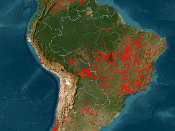
The Aqua Moderate Resolution Imaging Spectroradiometer (MODIS) Thermal Anomalies and Fire (MYD14) Version 6.1 product is produced daily in 5-minute temporal satellite increments (swaths). The MYD14 product is used to generate all of the higher level fire products, but can also be used to identify fires and other thermal anomalies, such as volcanoes. Each swath of data is approximately 2,030 kilometers along track (long), and 2,300 kilometers across track (wide).
Known Issues
- For complete information about known issues please refer to the MODIS/VIIRS Land Quality Assessment website.
Version Description
The following changes and improvements were implemented for inputs to MODIS Version 6.1 thermal anomalies and fire data products: (1) Version 6.1 Level-1B (L1B) products have been improved by undergoing various calibration changes that include: changes to the response-versus-scan angle (RVS) approach that affects reflectance bands for Aqua and Terra MODIS, corrections to adjust for the optical crosstalk in Terra MODIS infrared (IR) bands, and corrections to the Terra MODIS forward look-up table (LUT) update for the period 2012 – 2017, and (2) A polarization correction has been applied to the L1B Reflective Solar Bands (RSB).
Product Summary
Platforms
Instruments
Spatial Extent
Spatial Resolution
1000 Meters x 1000 Meters
Location
GLOBAL
Coordinate System
CARTESIAN
Granule Spatial Representation
GEODETIC
Temporal Extent
2002-07-04 to Present
Temporal Resolution
1 Day
Data Partner
Land Processes Distributed Active Archive Center (LP DAAC)
,
MODIS Adaptive Processing System, Terrestrial Information Systems Laboratory, Earth Sciences Division, Science and Exploration Directorate, Goddard Space Flight Center, NASA (NASA/GSFC/SED/ESD/TISL/MODAPS)
Concept ID
C2278858993-LPCLOUD
Data State
ACTIVE
Number of Files/Granules
2496193
Processing Level
2
Published
Updated
Science Keywords
Citation
Citation is critically important for dataset documentation and discovery. This dataset is openly shared, without restriction, in accordance with the EOSDIS Data Use and Citation Guidance.
Copy Citation
Citation Copied
Giglio, L., & Justice, C. (2021). MODIS/Aqua Thermal Anomalies/Fire 5-Min L2 Swath 1km V061 [Data set]. NASA Land Processes Distributed Active Archive Center. https://doi.org/10.5067/MODIS/MYD14.061 Date Accessed: 2026-05-26
Giglio, Louis, and Christopher Justice. “MODIS/Aqua Thermal Anomalies/Fire 5-Min L2 Swath 1km V061.” NASA Land Processes Distributed Active Archive Center, 2021. doi:10.5067/MODIS/MYD14.061. Date Accessed: 2026-05-26
Giglio, Louis, and Christopher Justice. MODIS/Aqua Thermal Anomalies/Fire 5-Min L2 Swath 1km V061. NASA Land Processes Distributed Active Archive Center, 2021, doi:10.5067/MODIS/MYD14.061. Date Accessed: 2026-05-26
File Naming Convention
MYD14.A2025224.0945.061.2025224201819.hdf
The file name begins with the Product Short Name (MYD14) followed by the Julian Date of Acquisition formatted as AYYYYDDD (A2025224), the Hours and Minutes of Acquisition provided as HHMM (0945), the Version of the data collection (061), the Julian Date and Time of Production designated as YYYYDDDHHMMSS (2025224201819), and the Data Format (hdf).
TABLE OF CONTENTS
Documents
USER'S GUIDE
ALGORITHM THEORETICAL BASIS DOCUMENT (ATBD)
PRODUCT QUALITY ASSESSMENT
SCIENCE DATA PRODUCT VALIDATION
Dataset Resources
Learn how to interpret and utilize quality information within Moderate Resolution Imaging Spectroradiometer (MODIS) Thermal Anomalies and Fire data.
Tutorial
April 5, 2017
Learn how to use Moderate Resolution Imaging Spectroradiometer (MODIS) Thermal Anomalies and Fire data, interpret fire masks, and visualize data.
Tutorial
April 5, 2017
Learn how to access Moderate Resolution Imaging Spectroradiometer (MODIS) Thermal Anomalies and Fire data via Earthdata Search, covering product details and download steps.
Tutorial
April 5, 2017
SHOWING 3 OF 3
Publications Citing This Dataset
Filters
You're viewing 60 of 60