We are in the process of migrating all NASA Earth science data sites into Earthdata from now until end of 2026. Not all NASA Earth science data and resources will appear here until then. Thank you for your patience as we make this transition.
Read about the Web Unification Project
Platforms
Saildrone
Instruments
CTD
,
ADCP
,
ANEMOMETERS
,
FLUOROMETERS
,
TEMPERATURE SENSORS
,
HUMIDITY SENSORS
,
PYROMETERS
,
PAR SENSORS
,
BAROMETERS
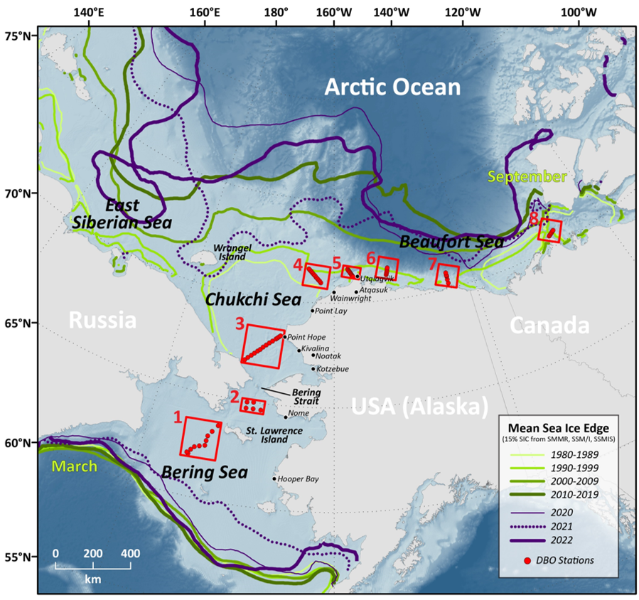
Spatial Extent
N: 71.6 S: 65.2 E: -157.2 W: -168.5
Location
ARCTIC OCEAN
Coordinate System
CARTESIAN
Granule Spatial Representation
CARTESIAN
Temporal Extent
2022-06-18 to 2022-08-17
Data Partner
Physical Oceanography Distributed Active Archive Center, Jet Propulsion Laboratory, NASA (NASA/JPL/PODAAC)
Concept ID
C2746559549-POCLOUD
Data State
COMPLETE
Number of Files/Granules
6
Processing Level
2
Science Keywords
Salinity
,
Conductivity
,
TEMPERATURE PROFILES
,
Ocean Chemistry
,
Ocean Temperature
,
Salinity/Density
,
Wind Direction
,
Chlorophyll Concentration
,
Oxygen
,
Atmospheric Pressure Measurements
,
Sea Level Pressure
,
Relative Humidity
,
Wind Direction
,
Air Temperature
,
Wave Height
,
Wave Period