We are in the process of migrating all NASA Earth science data sites into Earthdata from now until end of 2026. Not all NASA Earth science data and resources will appear here until then. Thank you for your patience as we make this transition.
Read about the Web Unification Project
StoryMaps
Esri StoryMaps created by NASA explore emerging Earth science data.
Filters

1 MIN READ
Our Earth Data Officer, Katie Baynes, spoke at the Federal GIS Conference Plenary. In case you missed her presentation, here is a story map for you to catch up on how NASA Earth data can be leveraged in your GIS project.
March 5, 2025
1 MIN READ
Work with data from the NASA/ISRO (Indian Space Research Organization) Synthetic Aperture Radar (NISAR) platform in ArcGIS Pro.
Feb. 26, 2025

1 MIN READ
Can summer salinity values help better predict ice formation in the fall?
Jan. 22, 2025

1 MIN READ
Learn about NASA's Aerosol Cloud meTeorology Interactions oVer the western ATlantic Experiment (ACTIVATE) campaign.
Jan. 22, 2025
1 MIN READ
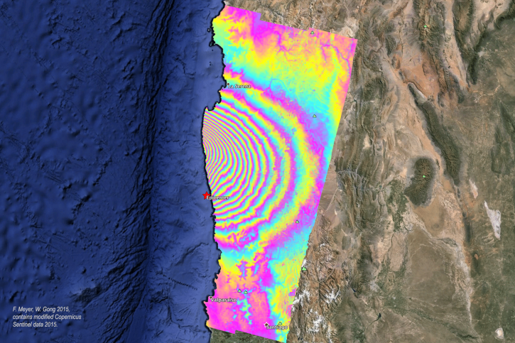
Order Sentinel-1 interferometric synthetic aperture radar (InSAR) products On Demand from NASA’s Alaska Satellite Facility Distributed Active Archive Center (ASF DAAC) for individual SLC bursts.
Nov. 1, 2024
1 MIN READ
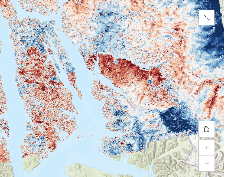
Learn about the water masking option provided by NASA’s Alaska Satellite Facility Distributed Active Archive Center (ASF DAAC) for on-demand Sentinel-1 interferometric synthetic aperture radar (InSAR).
Aug. 23, 2024

1 MIN READ
Discover the who, what, and why behind SASSIE's data collection.
Aug. 22, 2024

SHOWING 8 OF 57