Landslides Toolkit

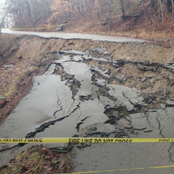
Landslides are some of the most common natural disasters, killing thousands of people each year. The mass movement of land (sediments and soils, bedrock and boulders, and even whole mountainsides) down a slope is induced by the force of gravity. There are numerous contributing forces to a landslide, many of which can be monitored or observed using remotely sensed data.

NASA Earth observing data provide important information for assessing landslide hazards. These data also provide information on factors contributing to landslides that can help in understanding the exposure and vulnerabilities of communities as well as damage assessment and response. This Toolkit is designed to support research into landslide-related disasters by providing easy access to data and other resources.

Discover and Visualize Data

Image
Global Precipitation Measurement (GPM); Integrated Multi-satellite Retrievals for GPM (IMERG) Final Precipitation Data in Earthdata Search. Earthdata Search is a data discovery application that enables access to NASA Earth Observing System Data and Information System (EOSDIS) Earth science data that are archived at and distributed by EOSDIS Distributed Active Archive Centers (DAACs).
Image

Rainfall

Intense or prolonged rainfall is the most frequent trigger of landslides. Excessive rainfall reduces friction between materials and increases water pressure within soil pores. This, in turn, increases the likelihood of slope failure.

Webinars

Data Tutorials/ Recipes

Image

Socioeconomic-related Landslide Data

Socioeconomic data help assess the exposure and vulnerability of a community to a landslide. Exposure is the presence of people, ecosystems, and infrastructure in places that could be adversely affected; vulnerability is the likelihood of being adversely affected.

Landslide Hazard

Population

Webinars

Data Tutorials/ Recipes

Image

Freeze/Thaw Conditions

As sediments go through the weathering process of freezing and thawing, the cohesion between rock grains is reduced. This destabilizes the overall structure of the material and contributes to landslides.

Webinars

Data Tutorials/Recipes

Image

Topography

An area’s slope is a critical factor in the potential for land movement and a community’s risk for being impacted by a landslide. Knowledge of local topography is essential for disaster managers and emergency response professionals to accurately assess an area’s risk for landslides and provide aid during a natural disaster.

Data Tutorials/Recipes

Image

Detecting Power Outages Using the Visible Infrared Imaging Radiometer Suite (VIIRS) Day/Night Band (DNB)

VIIRS DNB imagery shows Earth’s surface and atmosphere using a sensor designed to capture low-light emission sources under varying illumination conditions. This product is an excellent resource for assessing power outages across large areas. NASA’s Black Marble product removes cloud-contaminated pixels and corrects for atmospheric, terrain, vegetation, snow, lunar, and stray light effects on the VIIRS DNB radiances and enables nightlight data to be used effectively for scientific observations.

Image

Soil Moisture

The amount of soil moisture in an area prior to a rainfall event is an important variable in landslide potential. Rainfall decreases soil shear strength by increasing soil saturation. Oversaturated soil can increase landslide potential and contribute to excess runoff.

Webinars

Data Tutorials/Recipes

Image

Vegetation

Vegetation holds soil in place. Without the root systems of trees, bushes, and plants land is more likely to slide away. Slopes with sparse vegetation or that lose their vegetation to fire or drought are more vulnerable to landslides. Vegetation indices created from remotely sensed satellite data enable the assessment of vegetative health and the spatial extent of green, healthy vegetation.

Webinars

Data Tutorials/Recipes

Image

Land Surface Reflectance

Earthquakes and changes to the land surface from wildfires, road building, and deforestation can contribute to slope instability and trigger landslides. Specific spectral band combinations in the Moderate Resolution Imaging Spectroradiometer (MODIS) and VIIRS sensors make it easier to identify land surface areas that might be burned or free of vegetation and more prone to landslides.

Webinars

Data Tutorials/Recipes

Image

Synthetic Aperture Radar (SAR)

The wavelengths used for creating SAR imagery can penetrate clouds, smoke, soil, ice, and tree canopies, meaning that high-relief SAR imagery can be created day or night, rain or shine. SAR can be used to precisely measure changes in land elevation, such as after a landslide.

Webinars

Data Tutorials/Recipes


Last Updated