As NASA’s Tropospheric Emissions: Monitoring of Pollution (TEMPO) was launched into space in April 2023, researchers hoped it would be the next great tool for air quality monitoring. From its orbit 22,000 miles above Earth, the instrument offered a truly new way to measure atmospheric gases and pollutants over North America.
Day and night, officials and scientific experts from Minnesota to Europe are finding TEMPO data gives them access to air quality observations that are more comprehensive, frequent, and timely than ever before. In turn, users of the data are now able to see pollution in new ways to better protect the health of people.
“TEMPO gives us coverage every hour of the day across the continent,” said John Haynes, NASA’s program manager for Health and Air Quality applications and TEMPO’s program application lead. “It’s revolutionary as our first geostationary air quality satellite, and I think it has exceeded expectations.”
TEMPO’s Baseline Data
The TEMPO instrument is a grating spectrometer sensitive to visible and ultraviolet light. The sensor is installed on the Earth-facing side of the Intelsat 40e (IS-40e) commercial communications satellite, which hovers over Earth in geostationary orbit. TEMPO’s resolution is nearly 2 x 5 km per pixel, making it useful for measuring air quality from the scale of neighborhoods to an entire continent.
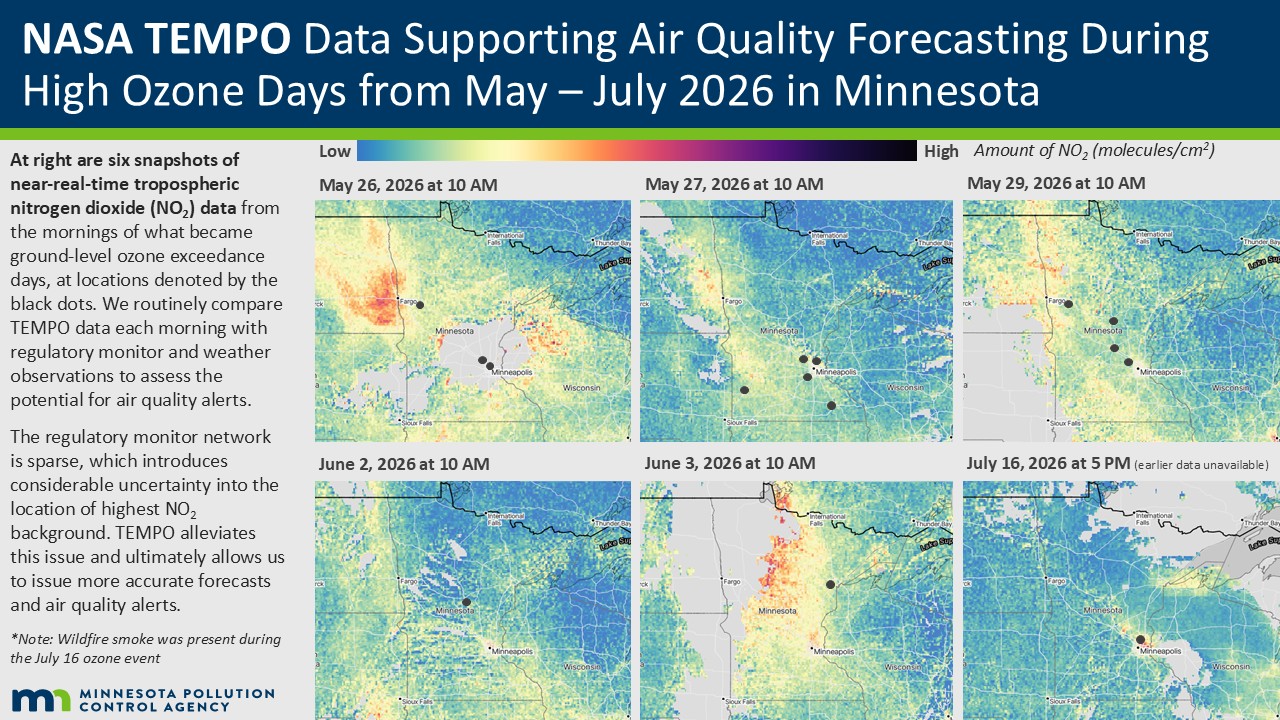
The instrument’s superpower is that it makes hourly scans of North America. Before TEMPO, data were only gathered in snapshots by satellites passing overhead about once a day. And if clouds were present at the time of the pass, little or no data might be gathered that day. With TEMPO’s hourly scans, clouds often move out of the way, providing more chances for clear-sky measurements.
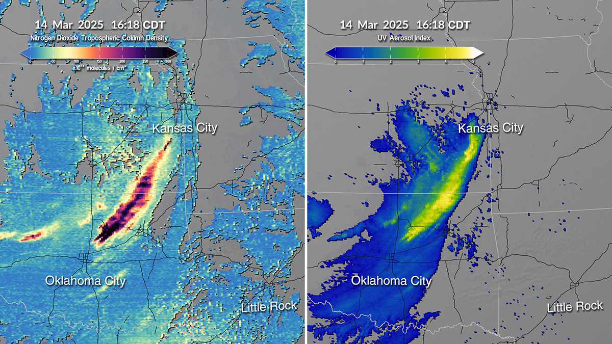
“With TEMPO, experts can now track how pollutant levels vary throughout the daytime, such as during and after traffic rush hours,” said Caroline Nowlan, TEMPO team scientist from the Harvard & Smithsonian Center for Astrophysics. “They also can get a more accurate picture of what’s in the air, how it changes, and can even locate emissions sources.”
Together, the data resolution and frequency allow experts to track gases and aerosols—across a day and as they move through the atmosphere—in finer and more frequent detail than ever before.
For the first phase of TEMPO’s mission, the sensor was programmed to make daylight measurements of gases and aerosols important to air quality and atmospheric composition and to track how they move. These measurements included:
- tropospheric and total column ozone
- tropospheric and total column nitrogen dioxide (NO2)
- total column formaldehyde
- cloud cover and height
- aerosol index
These baseline datasets are produced once a day and can be found on the TEMPO Data Access and Tools webpage. Some TEMPO datasets—including NO2, formaldehyde, cloud, and aerosol measurements—are also available in near real-time (NRT).
“Our users have been asking for faster access to these measurements, and now it takes only about 2 to 2 1/2 hours to produce the NRT data,” said Nowlan.
So far, the TEMPO NRT dataset includes more than 413 terabytes of data. And it is proving to be very popular. Since its creation, hundreds of users have downloaded more than 3.5 million TEMPO NRT files. Overall, users are downloading more than three million gigabytes of TEMPO data per year.
“In just three years, we have moved from what TEMPO will do to what TEMPO is actually delivering,” said Hazem Mahmoud, the project scientist for NASA’s Atmospheric Science Data Center (ASDC), which hosts TEMPO’s data. “The numbers show that users are adopting TEMPO data at scale.”
Since the first release of data, the TEMPO team has trained hundreds of people to find, access, and apply it. The training explains which pollutants TEMPO observes, why they matter for health, and how to access and visualize the data using tools and services that we provide.
When people can use the data themselves, Mahmoud noted, TEMPO's importance grows well beyond the science team.
Health Research and Policy Applications
Researchers care about air quality because of its effects on public health and on our planet. Air pollution is widely implicated in the onset of chronic diseases such as asthma and cancer. On the dirtiest days, air pollution is a trigger for heart attacks, emergency room visits, and deaths.
“With TEMPO, we strive to make sure the data are connected with epidemiologists, public health officials, and policymakers who can use it for important research and decision-making to improve and protect lives,” said Haynes.
One of the ways NASA and TEMPO are making those connections is through the Health and Air Quality Applied Sciences Team. HAQAST works in partnership with researchers, as well as public health and air quality agencies, to help them use NASA satellite data to solve real-world pollution problems.
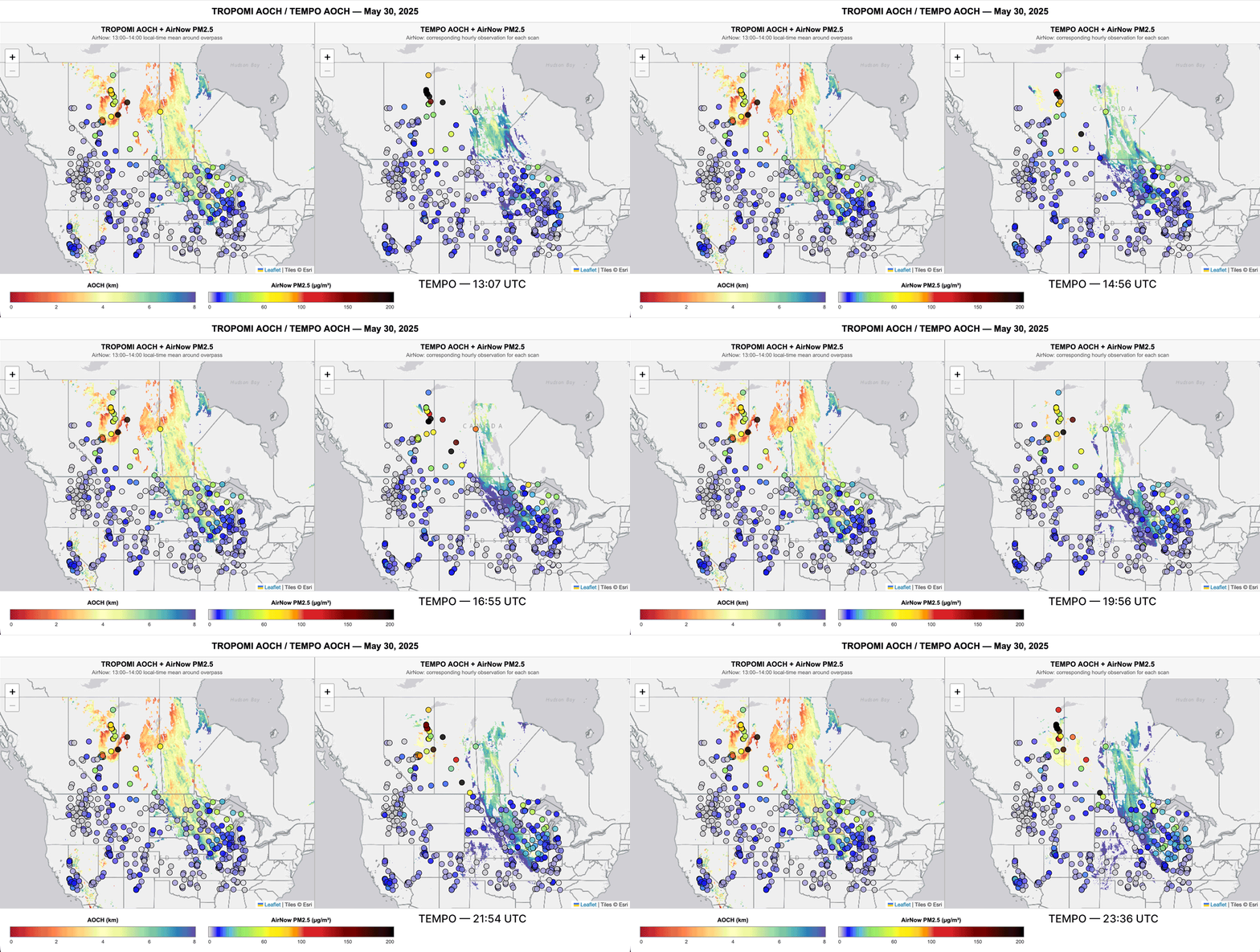
For example, HAQAST is funding research led by the University of Iowa to add TEMPO data to a wildfire smoke tracking system called FireAQ. Originally developed with NASA funding prior to TEMPO’s launch, FireAQ combines NRT Tropospheric Monitoring Instrument (TROPOMI) satellite data with computer modeling to make wildfire smoke forecasts. The forecasts are for use by federal, state, and local agencies, such as the National Oceanic and Atmospheric Administration. Now that TEMPO is flying over North America, FireAQ is being enhanced with that data, too.