Delivery of Suomi National Polar-orbiting Partnership (Suomi NPP) satellite data products will cease on November 1, 2026. Data users should transition now to alternative products from NOAA-21 and NOAA-20.
Suomi NPP data announcement
Fires and Smoke in Western Australia
Image captured on 25 August 2018, by the VIIRS instrument, aboard the joint NASA/NOAA Suomi NPP satellite.
Image
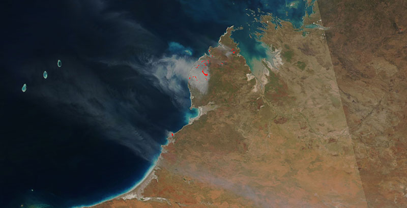
Fires and smoke on the Dampier Peninsula in Western Australia. This image was acquired on 25 August 2018 by the Visible Infrared Imaging Radiometer Suite (VIIRS) instrument, aboard the joint NASA/NOAA Suomi National Polar-orbiting Partnership (Suomi NPP) satellite.
View an animation of the progression of the fires on the Suomi-NPP/VIIRS false-color image using bands M11, I2, I1. This combination is most useful for distinguishing burn scars from naturally low vegetation or bare soil.
Visit Worldview to visualize near real-time data from NASA's Earth Observing System Data and Information System (EOSDIS).
Details
Last Updated
Published on
Nov. 3, 2020