We are in the process of migrating all NASA Earth science data sites into Earthdata from now until end of 2026. Not all NASA Earth science data and resources will appear here until then. Thank you for your patience as we make this transition.
Read about the Web Unification Project
Filters

Learn how NASA data shed light on heat wave-related deaths, informed machine learning regression models predicting honey harvests, and mapped maize crops.
Data in Action
Aug. 24, 2020

This ArcGIS Python Toolbox simplifies access to quality data by decoding complex quality information into usable thematic raster files.
Tutorial
Aug. 18, 2020

The experience may be different this summer, but almost a dozen interns are helping the ESDIS Project office and EOSDIS DAACs move vital work forward.
Feature Article
Aug. 12, 2020
Dr. Scheuchl and his team use SAR data to characterize Antarctica.
Data User Story
Aug. 8, 2020

Balk studies urbanization in the developing world, using a spatial framework to explore the demographic implications of climate-change issues.
News
Aug. 4, 2020
Scientists from SEDAC discussed climate and human geography as participants in the World Wide Human Geography Data Working Group.
Blog
July 30, 2020

The technical requirements for moving NASA EOSDIS data into the commercial cloud are enormous. Mark McInerney oversees this effort and helps ensure these data are interoperable with similar data from other agencies.
Data User Story
July 29, 2020
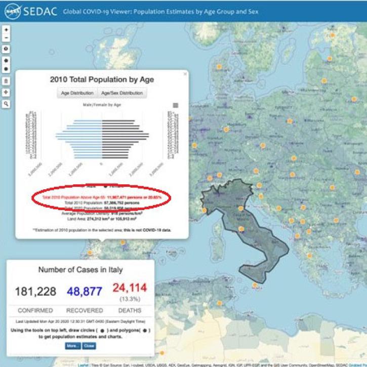
A new global mapping tool shows the number of people affected by the COVID-19 pandemic down to the U.S.-county level, and provides data on age and sex categories that can help identify populations most at risk.
Feature Article
July 29, 2020
SHOWING 8 OF 2367