We are in the process of migrating all NASA Earth science data sites into Earthdata from now until end of 2026. Not all NASA Earth science data and resources will appear here until then. Thank you for your patience as we make this transition.
Read about the Web Unification Project
Lightning Learning Resources
Webinars, tutorials, data recipes and more to help you work with Lightning.
Filters
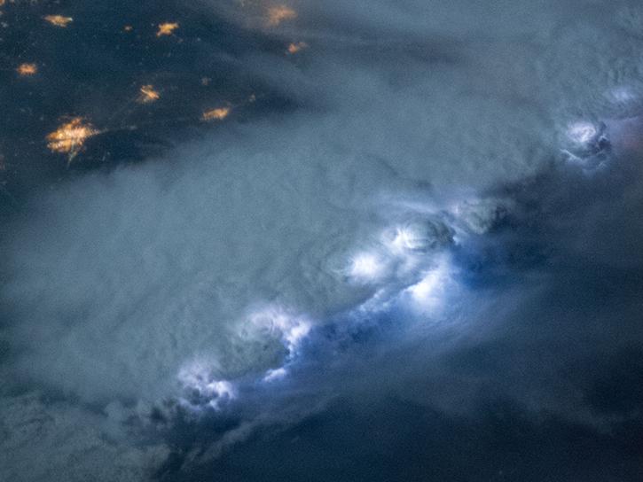
NASA's Lightning Imaging Sensor (LIS) surveyed lightning flashes of all shapes, sizes, and radiances across the tropics.
Data in Action
Oct. 19, 2018
NASA's Global Hydrology Resource Center Distributed Active Archive Center (GHRC DAAC) has released 10 different gridded lightning climatology datasets.
Data in Action
Oct. 19, 2018
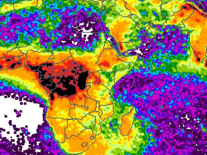
NASA climatology datasets have revealed Lake Maracaibo, Venezuela, as the peak lightning hotspot on Earth.
Data in Action
Oct. 19, 2018

Visualize lightning flash locations across several user-selected Lightning Imaging Sensor aboard the International Space Station (ISS LIS) swath data files and other processes.
Data Recipe
Jan. 4, 2018

This data recipe shows how to bring gridded netCDF data into ArcMap and create a GeoTIFF file enabling GIS analysis and map making.
Data Recipe
Oct. 10, 2017
This partial history outlines NASA's unsophisticated activities using shuttle video during the early phases of sprite research.
Data in Action
May 1, 1998

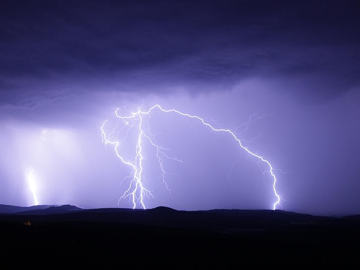
The payload bay TV cameras aboard NASA's space shuttle enabled researchers to study lightning in the stratosphere above thunderstorms.
Data in Action
Aug. 3, 1994
SHOWING 7 OF 15
Frequently Asked Questions
Earthdata Forum
Our online forum provides a space for users to browse thousands of FAQs about research needs, data, and data applications. You can also submit new questions for our experts to answer.
Submit Questions to Earthdata Forumand View Expert Responses