We are in the process of migrating all NASA Earth science data sites into Earthdata from now until end of 2026. Not all NASA Earth science data and resources will appear here until then. Thank you for your patience as we make this transition.
Read about the Web Unification Project
Atmosphere News
Articles, resources, and announcements from Atmosphere.
NASA researchers and data offer new insights into the impish and interesting visual phenomenon of sunglint in satellite imagery.
Feature Article
June 25, 2024
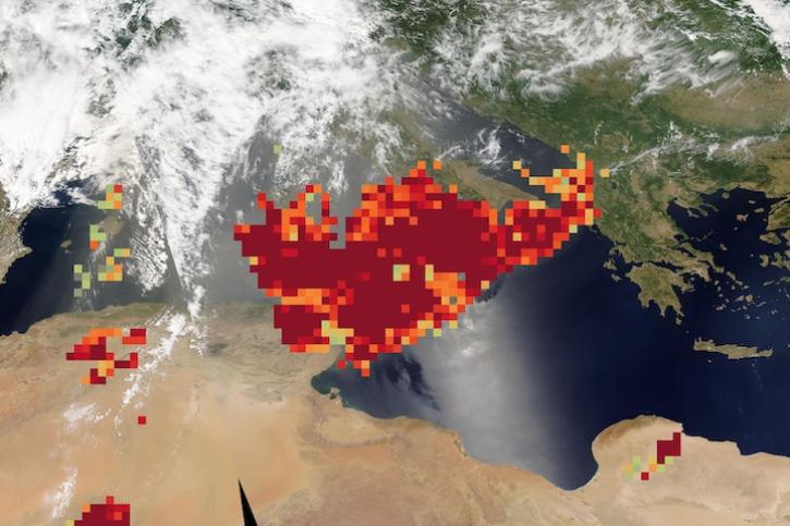
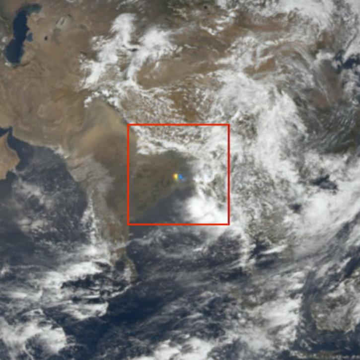
Image captured on June 20, 2024, by the MODIS and AIRS instruments aboard NASA's Aqua satellite.
Worldview Image of the Week
June 20, 2024
The new application from NASA's Prediction Of Worldwide Energy Resources (POWER) Project replaces its previous Data Access Viewer.
News
June 10, 2024
New carbon dioxide and methane data, expanded spatial and temporal resolution for several datasets, and an enhanced data exploration environment are some of the updates in this beta release.
News
June 4, 2024
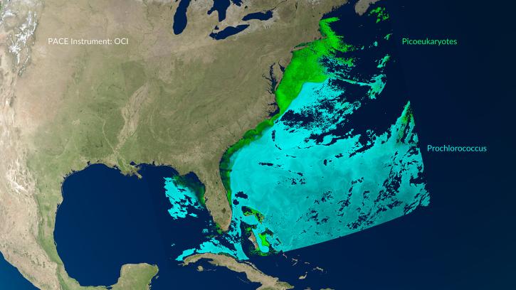
A series of Jupyter notebook tutorials show how to retrieve and use data from NASA's Plankton, Aerosol, Cloud, ocean Ecosystem (PACE) mission.
News
May 31, 2024
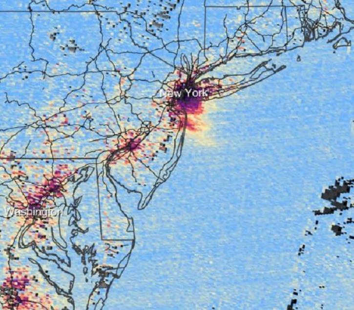
The beta release of Tropospheric Emissions: Monitoring of Pollution (TEMPO) mission data products lets users begin developing applications using these data.
News
May 30, 2024
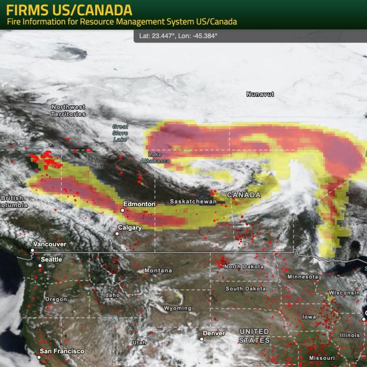
NASA’s Fire Information for Resource Management System (FIRMS) provides natural resource managers with near real-time active fire/hotspot locations using satellite-derived fire information.
Blog
May 24, 2024

Base true-color corrected reflectance image acquired by the VIIRS instrument aboard the joint NASA/NOAA Suomi NPP satellite on May 21, 2024, overlaid with the Fires and Thermal Anomalies and Aerosol Index layers.
Worldview Image of the Week
May 23, 2024
SHOWING 8 OF 677