
What are weather forecasts? 

Forecasts are predictions about the future state of a system—like seasonal climate patterns or daily weather—based on available data. Weather forecasting as a science incorporates observations of precipitation, wind, temperature, cloud cover, and many other atmospheric variables into robust mathematical models. 

Weather forecasts are a common part of everyday life and commerce. But weather forecasts help us predict, prepare for, and recover from natural hazards. They also can help identify areas vulnerable to floods or drought, alert communities to major storms, or help farmers manage their crops in the face of changing weather.

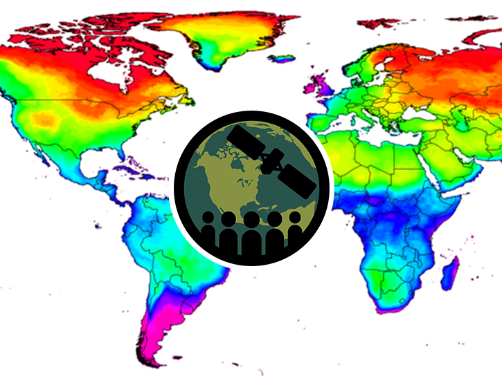
How do we contribute to weather forecasts? 

NASA provides a range of datasets and tools that can aid weather forecasters in other government agencies and research institutions. 

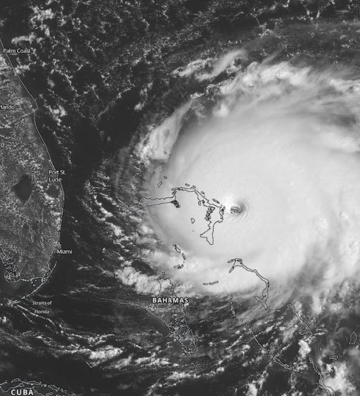
For instance, the Global Precipitation Measurement (GPM) mission provides data on global precipitation patterns. The Advanced Microwave Sounding Unit (AMSU) on the Aqua platform takes vertical profiles of atmospheric temperatures, allowing scientists to model rainfall and temperature variations. 

Instruments like the Visible Infrared Imaging Radiometer Suite (VIIRS) track land and sea surface temperatures, as well as cloud cover, while the Cyclone Global Navigation Satellite System (CYGNSS) measures wind speeds over the ocean to help monitor tropical storm conditions. 

These satellite observations are powerful on their own, but researchers combine these with ground, sea, and airborne measurements to create more robust weather and climate models that inform daily weather forecasts and long-term models of climate and precipitation.

NASA provides a wide catalog of climate and environmental data, as well as tutorials for integrating them into climate and weather models. 

Get Weather Forecast Data

Access a range of datasets and data tools to further your weather forecast research.
 

Learn How to Use Weather Forecast Data

Access a range of webinars, tutorials, data recipes, and data stories to enhance your knowledge of Earth Observation data.
ARSET - Monitoring and Modeling Floods using Earth Observations thumbnail image
Monitoring and Modeling Floods Using Earth Observations
This ARSET training focuses on developments and updates in flood monitoring tools and flood modeling techniques.
ARSET Assessing Extreme Weather Statistics using NASA Earth eXchange Global Daily Downscaled Projections (NEX-GDDP-CMIP6)  thumbnail image
Assessing Extreme Weather Statistics using NASA Earth eXchange Global Daily Downscaled Projections (NEX-GDDP-CMIP6)
This ARSET training focuses on assessing projected statistics of extreme heat and cold wave events and extreme precipitation excess and deficit events.
Hurricane Dorian making landfall on the Bahamas on September 1, 2019.
Improving Hurricane Forecasts with Near Real-Time Imagery and Data
Scientists at NASA's Short-Term Prediction Research and Transition (SPoRT) project use near real-time data to help the operational weather community with hurricane forecasting.
This MODIS image from July 19, 2006, shows muddy water from the rangeland-dominated Fitzroy River catchment entering the waters near the Great Barrier Reef,
Cloud to Cloud: Forecasting Storm Severity with Lightning
Forecasters find that lightning may help predict whether developing storms will become severe.
Discover and Visualize Weather Data
NASA data help us understand Earth's changing systems in more detail than ever before, and visualizations help make Earth science concepts accessible, beautiful, and impactful.
Data visualization is a powerful tool for analysis, trend and pattern recognition, and communication. Our resources help you find data visualizations to complement and enhance your research. We also have tools and tutorials to help you translate weather data into compelling visuals.
Image
Typhoon Jangmie, May 30, 2026
Typhoon Jangmie, off the coast of Japan, May 30, 2026. This image was captured by the Visible Infrared Imaging Radiometer Suite (VIIRS) on the Suomi NPP satellite.

Join Our Community of NASA Data Users

While NASA data are openly available without restriction, an Earthdata Login is required to download data and to use some tools with full functionality.

Learn About the Benefits of Earthdata Login

Frequently Asked Questions

Earthdata Forum

Our online forum provides a space for users to browse thousands of FAQs about research needs, data, and data applications. You can also submit new questions for our experts to answer.

Submit Questions to Earthdata Forumand View Expert Responses

Earthdata
Forum