We are in the process of migrating all NASA Earth science data sites into Earthdata from now until end of 2026. Not all NASA Earth science data and resources will appear here until then. Thank you for your patience as we make this transition.
Read about the Web Unification Project
Glaciers/Ice Sheets Learning Resources
Webinars, tutorials, data recipes and more to help you work with Glaciers/Ice Sheets.
Filters
Join us for a tour of enhanced data product landing pages, new user resources, data visualization tools, and a Jupyter Notebook tutorial to access cryospheric data at NSIDC DAAC.
Webinar
Aug. 16, 2022

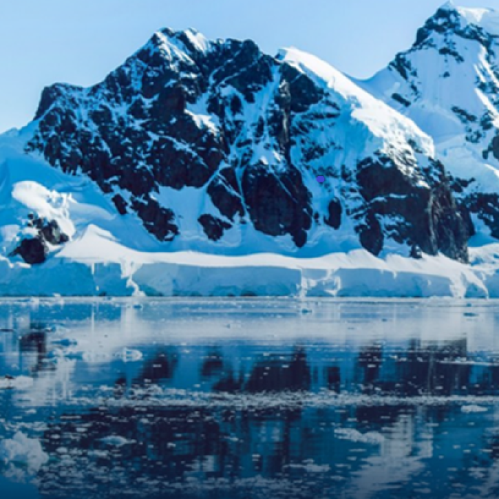
NASA’s Operation IceBridge airborne mission has flown over 700 flights through some of the most stunning regions of the Arctic and Antarctic. Join us to learn how to discover and access data that “bridges” the gap between the ICESat and ICESat-2 missions.
Webinar
April 19, 2022

This webinar demonstrates the capabilities and use of SeaDAS (Version 7 and later), NASA's free and publicly available software which enables users from their standard desktop and laptop computers to process,visualize, and analyze remote sensing data.
Webinar
April 15, 2022

Explore how scientists use NASA Earth observation data to monitor Arctic lake temperatures, map urban heat variations, and track endangered Shoebill movements across three diverse ecosystems.
Data in Action
Nov. 8, 2021

Researchers used remote sensing to investigate how subsurface ocean temperature variations have changed glaciers over the past 30 years.
Data in Action
Jan. 20, 2021
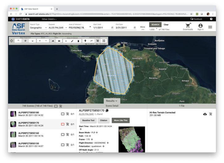
Learn how to discover, access and manipulate SAR data with the newly revamped NASA ASF DAAC Vertex tool. We'll showcase common data access methods and some of the advanced features of this data discovery and data access tool.
Webinar
Nov. 4, 2020

Learn how the Oceans Melting Greenland (OMG) projects surveys Greenland’s glaciers and ice sheets and studies how the oceans and ice interact with each other.
Data in Action
Feb. 27, 2017

The Global Land Ice Measurements from Space (GLIMS) initiative uses satellite data to track glacier changes, providing vital data for climate and hazard studies.
Data in Action
Dec. 14, 2016
SHOWING 8 OF 16
Frequently Asked Questions
Earthdata Forum
Our online forum provides a space for users to browse thousands of FAQs about research needs, data, and data applications. You can also submit new questions for our experts to answer.
Submit Questions to Earthdata Forumand View Expert Responses