We are in the process of migrating all NASA Earth science data sites into Earthdata from now until end of 2026. Not all NASA Earth science data and resources will appear here until then. Thank you for your patience as we make this transition.
Read about the Web Unification Project
Natural Hazards News
Articles, resources, and announcements from Natural Hazards.

Is the delicate relationship between fire and plants changing?
Feature Article
March 1, 2021

Image captured on 5 February 2021, by the MSI instrument, aboard ESA's Sentinel 2A and 2B satellites.
Worldview Image of the Week
Feb. 22, 2021

Image captured on 31 January 2021, by the VIIRS instrument, aboard the joint NASA/NOAA Suomi NPP satellite.
Worldview Image of the Week
Feb. 8, 2021
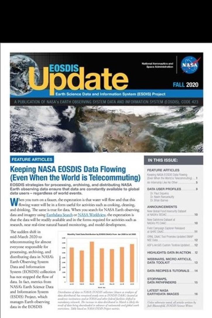
Find EOSDIS dataset and data tool news, top stories, featured data images, webinars, links to new learning resources, data recipes, and data user profiles.
News
Jan. 27, 2021

FIRMS US/Canada is a new version of Fire Information for Resource Management System (FIRMS).
Blog
Jan. 9, 2021

The Global Navigation Satellite System (GNSS) enables the precise location of points on Earth’s surface. For geodesists like Dr. Herring, it also is a key geodetic technique for his studies of surface deformation processes.
Data User Story
Jan. 7, 2021


Science and relief efforts come together in the aftermath of the 2005 Kashmir earthquake.
Feature Article
Dec. 28, 2020
SHOWING 8 OF 534