We are in the process of migrating all NASA Earth science data sites into Earthdata from now until end of 2026. Not all NASA Earth science data and resources will appear here until then. Thank you for your patience as we make this transition.
Read about the Web Unification Project
Terrain Elevation Learning Resources
Webinars, tutorials, data recipes and more to help you work with Terrain Elevation.
Filters

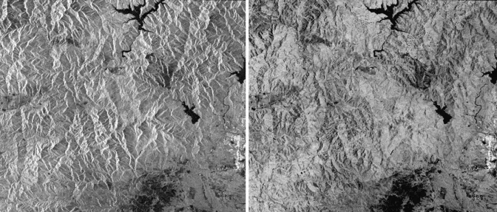
Work with radiometrically terrain corrected (RTC) Sentinel-1 synthetic aperture radar (SAR) datasets from NASA’s Alaska Satellite Facility Distributed Active Archive Center (ASF DAAC).
StoryMap
Nov. 11, 2020

Get to know NASA's Land Processes Distributed Active Archive Center (LP DAAC) in this Tech Talk Webinar.
Webinar
Oct. 1, 2020

This ARSET training focuses on using interferometric synthetic aperture radar for characterizing landslides and generating a digital elevation model.
Training
Dec. 3-5, 2019
Esta capacitación de ARSET cubre el uso de SAR interferométrico para caracterizar deslizamientos y generar modelos de elevación digitales.
Training
Dec. 3-5, 2019

This ARSET training focuses on describing NASA digital elevation data and its application in deriving river basin information using HydroSHEDS.
Training
Nov. 26, 2019
This data recipe guides users to terrain correct CEOS-formatted data granules for legacy platforms.
Data Recipe
Oct. 18, 2016

Researchers used MODIS and ASTER data to analyze how the Three Gorges Dam's construction altered vegetation along the Yangtze River's riparian zones.
Data in Action
April 29, 2015

See how digital elevation models are used to create three-dimensional data visualizations, which provide an insightful perspective on landscapes.
Data in Action
Aug. 18, 2014
SHOWING 8 OF 24
Frequently Asked Questions
Earthdata Forum
Our online forum provides a space for users to browse thousands of FAQs about research needs, data, and data applications. You can also submit new questions for our experts to answer.
Submit Questions to Earthdata Forumand View Expert Responses