From discovery to visualization, data tools such as GeoGateway, NASA Worldview, and Earthdata Search guide users in making the most of earthquake data.
Earthquakes Data Access and Tools
Earthquakes Datasets
| Dataset Sort descending | Version | Platform | Instrument | Temporal Extent | Spatial Extent | Spatial Resolution | Data Format |
|---|---|---|---|---|---|---|---|
| Sentinel-1B Single Look Complex Product | 1 | Sentinel-1B | C-SAR | 2016-04-25 to 2021-12-24 |
N: 90 S: -90 E: 180 W: -180 |
||
| Sentinel-1B Single Look Complex Product Metadata | 1 | Sentinel-1B | C-SAR | 2016-04-25 to 2021-12-24 |
N: 90 S: -90 E: 180 W: -180 |
||
| Sentinel-1B Single Polarization High Resolution Ground Range Detected Product | 1 | Sentinel-1B | C-SAR | 2016-04-25 to 2021-12-24 |
N: 90 S: -90 E: 180 W: -180 |
||
| Sentinel-1B Single Polarization High Resolution Ground Range Detected Product Metadata | 1 | Sentinel-1B | C-SAR | 2016-04-25 to 2021-12-24 |
N: 90 S: -90 E: 180 W: -180 |
||
| Sentinel-1B Single Polarization Medium Resolution Ground Range Detected Product | 1 | Sentinel-1B | C-SAR | 2016-04-25 to 2021-12-24 |
N: 90 S: -90 E: 180 W: -180 |
||
| Sentinel-1B Single Polarization Medium Resolution Ground Range Detected Product Metadata | 1 | Sentinel-1B | C-SAR | 2016-04-25 to 2021-12-24 |
N: 90 S: -90 E: 180 W: -180 |
||
| U.S. Climate Risk Projections by County, 2040-2049 | 1.00 | MODELS | Computer | 2040-01-01 to 2049-12-31 |
N: 72 S: 17 E: -65 W: -180 |
Shapefile, PDF, PNG, Excel | |
| Very Long Baseline Interferometry (VLBI) Data and Products Supporting Information from NASA CDDIS | 1 | GROUND STATIONS | RF ANTENNA | 1979-01-01 to Present |
N: 90 S: -90 E: 180 W: -180 |
ASCII |
Featured Earthquakes Observation Method: Sentinel-1 C-SAR
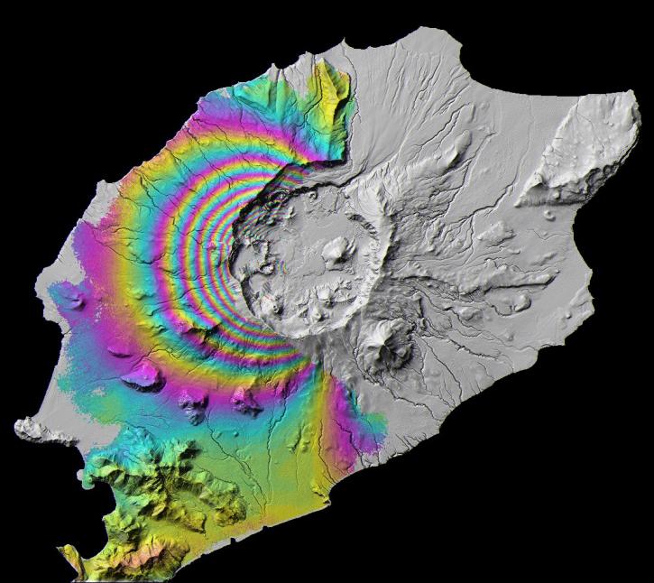
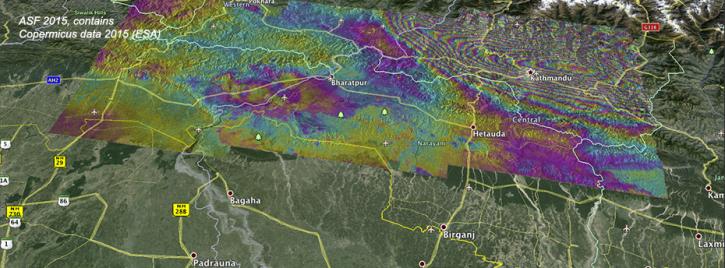
The Synthetic Aperture Radar (SAR) aboard the ESA (European Space Agency's) Sentinel-1A/B satellites provides continuous all-weather, day-and-night land imagery. SAR images can be combined to produce interferograms, which are images showing changes in land height or position associated with earthquakes.
Earthquakes Data Tools
| Tool Sort descending | Description | Services | |
|---|---|---|---|
| GUARDIAN | The GNSS-based Upper Atmospheric Realtime Disaster Information and Alert Network (GUARDIAN) is a near real-time (NRT) ionospheric monitoring tool for natural hazards warning. | Monitoring Natural Events | |
| Panoply | Panoply is a cross-platform application that plots geo-referenced and other arrays from netCDF, HDF, GRIB, and other datasets. | Visualization, Customization, Reformatting, Subsetting, Comparison | |
| Vertex | Vertex is a graphical search interface for finding synthetic aperture radar (SAR) data. | Search and Discovery, Access, Downloading, Processing, Subsetting |
Frequently Asked Questions
Earthdata Forum
Our online forum provides a space for users to browse thousands of FAQs about research needs, data, and data applications. You can also submit new questions for our experts to answer.
Submit Questions to Earthdata Forumand View Expert Responses