Delivery of Suomi National Polar-orbiting Partnership (Suomi NPP) satellite data products will cease on November 1, 2026. Data users should transition now to alternative products from NOAA-21 and NOAA-20.
Suomi NPP data announcement
Tectonics Data Access and Tools
Tectonics Datasets
| Dataset Sort descending | Version | Platform | Instrument | Temporal Extent | Spatial Extent | Spatial Resolution | Data Format |
|---|---|---|---|---|---|---|---|
| Global Navigation Satellite System (GNSS) IGS Ionosphere Vertical Total Electron Content (VTEC) Final Product from NASA CDDIS | 1 | Beidou, Galileo, GLONASS, GPS, GROUND STATIONS, QZSS, IRNSS, SBAS | Beidou P, Galileo P, GLONASS P, GPSP, GNSS, QZSS P, IRNSS P, SBAS P | 1998-01-01 to Present |
N: 90 S: -90 E: 180 W: -180 |
IONEX (ionosphere exchange) | |
| Global Navigation Satellite System (GNSS) IGS Multi-GNSS Experiment (MGEX) Products from NASA CDDIS | 1 | Beidou, Galileo, GLONASS, GPS, GROUND STATIONS, QZSS, IRNSS, SBAS | Beidou P, Galileo P, GLONASS P, GPSP, GNSS, QZSS P, IRNSS P, SBAS P | 2009-02-01 to Present |
N: 90 S: -90 E: 180 W: -180 |
SINEX, SP3, ASCII | |
| Global Navigation Satellite System (GNSS) IGS Predicted Ionosphere Vertical Total Electron Content (VTEC) Grid Product from NASA CDDIS | 1 | Beidou, Galileo, GLONASS, GPS, GROUND STATIONS, QZSS, IRNSS, SBAS | Beidou P, Galileo P, GLONASS P, GPSP, GNSS, QZSS P, IRNSS P, SBAS P | 1998-01-01 to Present |
N: 90 S: -90 E: 180 W: -180 |
IONEX | |
| Global Navigation Satellite System (GNSS) IGS Rapid Combined Earth Rotation Parameter (ERP) Product from NASA CDDIS | 1 | Beidou, Galileo, GLONASS, GPS, GROUND STATIONS, QZSS, IRNSS, SBAS | Beidou P, Galileo P, GLONASS P, GPSP, GNSS, QZSS P, IRNSS P, SBAS P | 1992-01-01 to Present |
N: 90 S: -90 E: 180 W: -180 |
IGS ERP | |
| Global Navigation Satellite System (GNSS) IGS Rapid Combined Orbit Solution (daily files, generated daily) Product from NASA CDDIS | 1 | Beidou, Galileo, GLONASS, GPS, GROUND STATIONS, QZSS, IRNSS, SBAS | Beidou P, Galileo P, GLONASS P, GPSP, GNSS, QZSS P, IRNSS P, SBAS P | 1992-01-01 to Present |
N: 90 S: -90 E: 180 W: -180 |
extended standard product-3 (SP3c) | |
| Global Navigation Satellite System (GNSS) IGS Rapid Combined Satellite and Receiver 5-Minute Clock Solution (30-second resolution, daily files, generated daily) Product from NASA CDDIS | 1 | Beidou, Galileo, GLONASS, GPS, GROUND STATIONS, QZSS, IRNSS, SBAS | Beidou P, Galileo P, GLONASS P, GPSP, GNSS, QZSS P, IRNSS P, SBAS P | 1992-01-01 to Present |
N: 90 S: -90 E: 180 W: -180 |
clock RINEX format | |
| Global Navigation Satellite System (GNSS) IGS Rapid Daily Ionosphere Vertical Total Electron Content (VTEC) Grid Product from NASA CDDIS | 1 | Beidou, Galileo, GLONASS, GPS, GROUND STATIONS, QZSS, IRNSS, SBAS | Beidou P, Galileo P, GLONASS P, GPSP, GNSS, QZSS P, IRNSS P, SBAS P | 1998-01-01 to Present |
N: 90 S: -90 E: 180 W: -180 |
IONEX (ionosphere exchange) format | |
| Global Navigation Satellite System (GNSS) IGS Rapid High-Rate Ionosphere Vertical Total Electron Content (VTEC) Grid Product from NASA CDDIS | 1 | Beidou, Galileo, GLONASS, GPS, GROUND STATIONS, QZSS, IRNSS, SBAS | Beidou P, Galileo P, GLONASS P, GPSP, GNSS, QZSS P, IRNSS P, SBAS P | 1998-01-01 to Present |
N: 90 S: -90 E: 180 W: -180 |
IONEX | |
| Global Navigation Satellite System (GNSS) IGS Rapid Orbit/Clock/Earth Rotation Parameters (ERP) Product Summary from NASA CDDIS | 1 | Beidou, Galileo, GLONASS, GPS, GROUND STATIONS, QZSS, IRNSS, SBAS | Beidou P, Galileo P, GLONASS P, GPSP, GNSS, QZSS P, IRNSS P, SBAS P | 1992-01-01 to Present |
N: 90 S: -90 E: 180 W: -180 |
clock RINEX format | |
| Global Navigation Satellite System (GNSS) IGS Real-Time Clock Combination of Real-Time Analysis Center (AC) Submissions Product from NASA CDDIS | 1 | Beidou, Galileo, GLONASS, GPS, GROUND STATIONS, QZSS, IRNSS, SBAS | Beidou P, Galileo P, GLONASS P, GPSP, GNSS, QZSS P, IRNSS P, SBAS P | 2009-02-01 to Present |
N: 90 S: -90 E: 180 W: -180 |
RINEX | |
| Global Navigation Satellite System (GNSS) IGS Real-Time Combination Solution Summary of Real-Time Analysis Center (AC) Submissions from NASA CDDIS | 1 | Beidou, Galileo, GLONASS, GPS, GROUND STATIONS, QZSS, IRNSS, SBAS | Beidou P, Galileo P, GLONASS P, GPSP, GNSS, QZSS P, IRNSS P, SBAS P | 2009-02-01 to Present |
N: 90 S: -90 E: 180 W: -180 |
RTCM | |
| Global Navigation Satellite System (GNSS) IGS Residuals Between Daily Analysis Center (AC) and Combined Final Station Position Solution Product from NASA CDDIS | 1 | Beidou, Galileo, GLONASS, GPS, GROUND STATIONS, QZSS, IRNSS, SBAS | Beidou P, Galileo P, GLONASS P, GPSP, GNSS, QZSS P, IRNSS P, SBAS P | 1992-01-01 to Present |
N: 90 S: -90 E: 180 W: -180 |
Text, UNIX compressed ASCII | |
| Global Navigation Satellite System (GNSS) IGS Summary of Orbit and Clock Comparisons of Analysis Center (AC) and Combination Real-Time Solutions with IGS Rapid Solutions from NASA CDDIS | 1 | Beidou, Galileo, GLONASS, GPS, GROUND STATIONS, QZSS, IRNSS, SBAS | Beidou P, Galileo P, GLONASS P, GPSP, GNSS, QZSS P, IRNSS P, SBAS P | 2009-02-01 to Present |
N: 90 S: -90 E: 180 W: -180 |
RINEX | |
| Global Navigation Satellite System (GNSS) IGS Ultra-Rapid Combined Earth Rotation Parameters (ERP) Product from NASA CDDIS | 1 | Beidou, Galileo, GLONASS, GPS, GROUND STATIONS, QZSS, IRNSS, SBAS | Beidou P, Galileo P, GLONASS P, GPSP, GNSS, QZSS P, IRNSS P, SBAS P | 1992-01-01 to Present |
N: 90 S: -90 E: 180 W: -180 |
IGS ERP | |
| Global Navigation Satellite System (GNSS) IGS Ultra-Rapid Combined Orbit Solution Product (sub-daily files, generated 4 times/day) from NASA CDDIS | 1 | Beidou, Galileo, GLONASS, GPS, GROUND STATIONS, QZSS, IRNSS, SBAS | Beidou P, Galileo P, GLONASS P, GPSP, GNSS, QZSS P, IRNSS P, SBAS P | 1992-01-01 to Present |
N: 90 S: -90 E: 180 W: -180 |
extended standard product-3 (SP3c) | |
| Global Navigation Satellite System (GNSS) IGS Ultra-Rapid Combined Orbit Solution Summary Product from NASA CDDIS | 1 | Beidou, Galileo, GLONASS, GPS, GROUND STATIONS, QZSS, IRNSS, SBAS | Beidou P, Galileo P, GLONASS P, GPSP, GNSS, QZSS P, IRNSS P, SBAS P | 1992-01-01 to Present |
N: 90 S: -90 E: 180 W: -180 |
Text File | |
| Global Navigation Satellite System (GNSS) IGS Ultra-Rapid Orbit Solution Comparison Summary Product from NASA CDDIS | 1 | Beidou, Galileo, GLONASS, GPS, GROUND STATIONS, QZSS, IRNSS, SBAS | Beidou P, Galileo P, GLONASS P, GPSP, GNSS, QZSS P, IRNSS P, SBAS P | 1992-01-01 to Present |
N: 90 S: -90 E: 180 W: -180 |
Text File | |
| Global Navigation Satellite System (GNSS) IGS Weekly Ionosphere Vertical Total Electron Content (VTEC) Grid Validation Product from NASA CDDIS | 1 | Beidou, Galileo, GLONASS, GPS, GROUND STATIONS, QZSS, IRNSS, SBAS | Beidou P, Galileo P, GLONASS P, GPS, GNSS, QZSS P, IRNSS P, SBAS P | 1998-01-01 to Present |
N: 90 S: -90 E: 180 W: -180 |
IONEX | |
| GNSS GLONASS Combined Broadcast Ephemeris Data (30-second sampling, daily files) from NASA CDDIS | 1 | GLONASS, GROUND STATIONS | GLONASS P, GNSS | 1992-01-01 to Present |
N: 90 S: -90 E: 180 W: -180 |
RINEX | |
| Ground-Based Doppler Orbitography and Radiopositioning Integrated by Satellite (DORIS) Cumulative Station Position Product from NASA CDDIS | 1 | OSTM/JASON-2, GROUND STATIONS, CRYOSAT-2, Sentinel-3A, SARAL, HY2-A, JASON-3, ENVISAT, TOPEX/POSEIDON, JASON-1, SPOT-2, SPOT-3, SPOT-4, SPOT-5 | DORIS, DORIS GROUND STATION BEACON | 1992-01-01 to Present |
N: 90 S: -90 E: 180 W: -180 |
SINEX | |
| Ground-Based Doppler Orbitography and Radiopositioning Integrated by Satellite (DORIS) Extension of the International Terrestrial Reference Frame (ITRF) for Precise Orbit Determination (DPOD) from NASA CDDIS | 1 | OSTM/JASON-2, GROUND STATIONS, CRYOSAT-2, SENTINEL-3A, SARAL, HY2-A, JASON-3, ENVISAT, TOPEX/POSEIDON, JASON-1, SPOT-2, SPOT-3, SPOT-4, SPOT-5 | DORIS, DORIS GROUND STATION BEACON | 1992-01-01 to Present |
N: 90 S: -90 E: 180 W: -180 |
IDS internal DPOD format | |
| Ground-Based Doppler Orbitography and Radiopositioning Integrated by Satellite (DORIS) IDS Coordinates of the Terrestrial Reference Frame (TRF) origin (Geocenter) Time Series Product from NASA CDDIS | 1 | OSTM/JASON-2, GROUND STATIONS, CRYOSAT-2, Sentinel-3A, SARAL, HY2-A, JASON-3, ENVISAT, TOPEX/POSEIDON, JASON-1, SPOT-2, SPOT-3, SPOT-4, SPOT-5, Sentinel-3B | DORIS, DORIS GROUND STATION BEACON | 1992-01-01 to Present |
N: 90 S: -90 E: 180 W: -180 |
Geocenter | |
| Ground-Based Doppler Orbitography and Radiopositioning Integrated by Satellite (DORIS) IDS Earth Orientation Parameters (EOP) Time Series Product from NASA CDDIS | 1 | GROUND-BASED OBSERVATIONS | DORIS | 1992-01-01 to Present |
N: 90 S: -90 E: 180 W: -180 |
EOP | |
| Ground-Based Doppler Orbitography and Radiopositioning Integrated by Satellite (DORIS) IDS Ionospheric Product from NASA CDDIS | 1 | GROUND STATIONS, ENVISAT, TOPEX/POSEIDON, JASON-1, SPOT-2, SPOT-4, SPOT-5, Sentinel-3B | DORIS GROUND STATION BEACON, DORIS | 1992-01-01 to Present |
N: 90 S: -90 E: 180 W: -180 |
SINEX | |
| Ground-Based Doppler Orbitography by Radiopositioning Integrated on Satellite (DORIS) Daily Data (raw files) from NASA CDDIS | 1 | OSTM/JASON-2, GROUND STATIONS, CRYOSAT-2, Sentinel-3A, SARAL, HY2-A, JASON-3 | DORIS, DORIS GROUND STATION BEACON | 1992-01-01 to Present |
N: 90 S: -90 E: 180 W: -180 |
RINEX DORIS 3.0 |
Featured Tectonics Observation Method: Sentinel-1 C-band Synthetic Aperture Radar
The ESA (European Space Agency's) Sentinel-1A/B satellites are equipped with synthetic aperture radar (SAR) instruments that record continuous all-weather, day-and-night imagery. SAR energy beams can penetrate cloud and tree canopy cover to detect very small changes to the height, shape, and position of Earth surfaces. The ability of Sentinel-1 to capture detailed SAR images anywhere at any time makes them excellent tools for producing interferograms and digital elevation models to track the movement of Earth's plates.

Join us as we show new and experienced users how to use Vertex to discover and access Sentinel-1 synthetic aperture radar (SAR) data at NASA's Alaska Satellite Facility (ASF) Distributed Active Archive Center (DAAC).
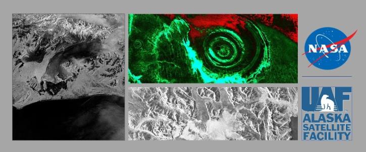
NASA's ASF DAAC has rolled out the first tool in its planned Advanced Products Toolbox for synthetic aperture radar (SAR) data with a single-command Radiometrically Terrain-Correct (RTC) tool. Join us for the tool demo and provide your input.
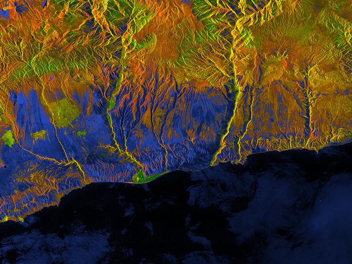
This webinar will introduce users to radiometrically terrain corrected (RTC) datasets and demonstrate the process of using Vertex to search for source granules, submit them for processing, and access the finished products.

NASA's ASF DAAC released the Global Seasonal Sentinel-1 Interferometric Coherence and Backscatter Dataset.
Tectonics Data Tools
| Tool Sort descending | Description | Services | |
|---|---|---|---|
| GUARDIAN | The GNSS-based Upper Atmospheric Realtime Disaster Information and Alert Network (GUARDIAN) is a near real-time (NRT) ionospheric monitoring tool for natural hazards warning. | Monitoring Natural Events |
SHOWING 1 OF 1
Get Help
QUESTIONS & SUPPORT
Have a question?
Get help with NASA Earth science data, datasets, tools, services, and metadata on the Earthdata Forum. Experienced staff in the data user community review and answer questions.
Get help on Earthdata ForumEarthdata
Forum
Forum