We are in the process of migrating all NASA Earth science data sites into Earthdata from now until end of 2026. Not all NASA Earth science data and resources will appear here until then. Thank you for your patience as we make this transition.
Read about the Web Unification Project
LP DAAC Learning Resources
Explore webinars, trainings, tutorials, and other learning resources from NASA’s Land Processes Distributed Active Archive Center (LP DAAC). Learn how to discover, access, process, and apply Earth science data from platforms and instruments such as MODIS, ASTER, VIIRS, GEDI, ECOSTRESS, EMIT, and HLS.
LP DAAC maintains a collection of dataset and topic-specific GitHub repositories that include step-by-step tutorials, scripts, guides, and example workflows for getting started with LP DAAC data. Users can browse available resources in the LP DAAC Data Resources GitHub repository, which serves as a central hub and provides links to additional LP DAAC–maintained GitHub repositories for specific datasets and topics.
Filters

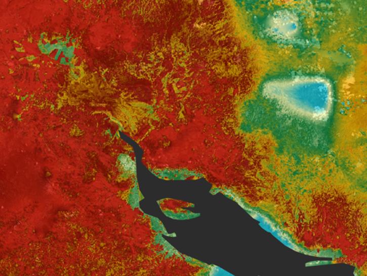
Remote sensing data's drought-indicating parameters are essential to manage the impact of water scarcities and minimize drought losses.
Data in Action
June 27, 2018
Learn how ECOSTRESS measures surface temperatures to assess plant water use and stress, aiming to optimize agricultural practices and support ecosystem health.
Tutorial
June 25, 2018

Learn how ASTER data are being used to study vegetation health and water in Africa.
Data in Action
May 23, 2018

Discover how remote sensing data support water monitoring, wildfire risk modeling, and identification of optimal rainwater harvesting locations.
Data in Action
April 25, 2018

Read how researchers from NASA's DEVELOP team analyzed temperature trends in the Northeast to create maps for the agricultural and energy industries.
Data in Action
April 13, 2018

Learn how a NASA DEVELOP project used MODIS and ASTER data to create a model of social vulnerability to fire hazards in the Appalachian forests.
Data in Action
March 7, 2018

See ASTER instrument images revealing the transformation of South Korea's Mount Gariwang for the 2018 Winter Olympics.
Data in Action
Feb. 21, 2018

This ARSET training introduces the Variable Infiltration Capacity Model, sources of satellite-derived input data, and implementation of the model.
Training
Feb. 15 - March 1, 2018
SHOWING 8 OF 226