We are in the process of migrating all NASA Earth science data sites into Earthdata from now until end of 2026. Not all NASA Earth science data and resources will appear here until then. Thank you for your patience as we make this transition.
Read about the Web Unification Project
OMPS SIPS News
Articles, resources, and announcements from OMPS SIPS.
Filters

The NLDAS-2 dataset was added to the AIMS decision-making platform to create hydrology and water quality simulations for farmers and land managers across the country.
News
May 14, 2026

This training offered by NASA's Applied Remote Sensing Training (ARSET) program covers applicable data sources for assessing groundwater change.
News
March 9, 2026

The OMPS instrument aboard the NASA/NOAA Suomi NPP platform captured imagery and data on March 5, 2026.
Worldview Image of the Week
March 6, 2026

Researchers used data from the GRACE/GRACE-FO platform to estimate that the region has lost a combined 34 cubic kilometers of groundwater since 2002.
Feature Article
Dec. 5, 2025
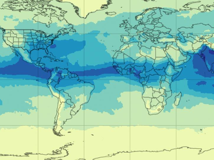
NASA's AIRS instrument provides information about precipitable water vapor, a key variable in determining the potential strength of hurricanes and tropical cyclones.
Blog
Sept. 30, 2025

Image captured September 24, 2025, by the VIIRS instrument aboard the joint NASA/NOAA NOAA-21 platform.
Worldview Image of the Week
Sept. 25, 2025

Image captured September 17, 2025, by the VIIRS instrument aboard the joint NASA/NOAA Suomi NPP platform.
Worldview Image of the Week
Sept. 18, 2025

A summary of datasets, products, and resources released by NASA’s Distributed Active Archive Centers (DAACs) in August 2025.
News
Sept. 4, 2025
SHOWING 8 OF 166