Description
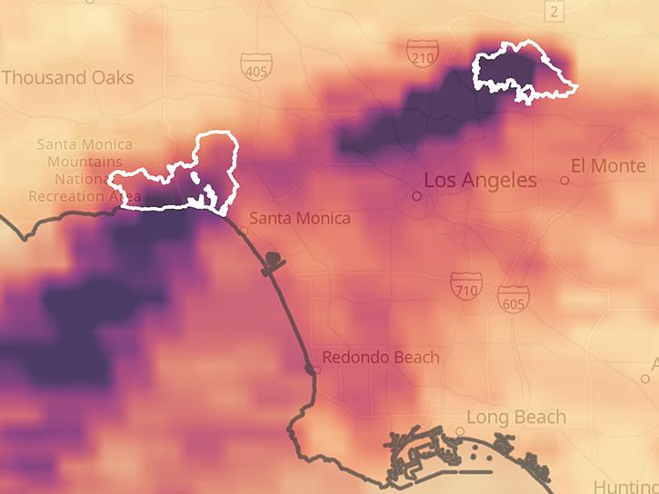
These data remain available for comparison/validation purposes of the V04 data. The TEMPO V04 data should be used for analysis and applications. Nitrogen dioxide Level 2 files provide trace gas information at TEMPO’s native spatial resolution, ~10 km^2 at the center of the Field of Regard (FOR), for individual granules. Each granule covers the entire North-South TEMPO FOR but only a portion of the East-West FOR. The files are provided in netCDF4 format, and contain information on tropospheric, stratospheric and total nitrogen dioxide vertical columns, ancillary data used in air mass factor and stratospheric/tropospheric separation calculations, and retrieval quality flags. The retrieval uses a three-step approach: (1) spectral fitting of slant columns, (2) air mass factor calculation and derivation of vertical columns, and (3) stratospheric/tropospheric separation. These data reached provisional validation on December 9, 2024.
Product Summary
Citation
Citation is critically important for dataset documentation and discovery. This dataset is openly shared, without restriction, in accordance with the EOSDIS Data Use and Citation Guidance.
Copy Citation
Documents
ALGORITHM THEORETICAL BASIS DOCUMENT (ATBD)
SCIENCE DATA PRODUCT VALIDATION
GENERAL DOCUMENTATION
DATA CITATION GUIDELINES
Dataset Resources
Get Help
QUESTIONS & SUPPORT
Get help with NASA Earth science data, datasets, tools, services, and metadata on the Earthdata Forum. Experienced staff in the data user community review and answer questions.
Get help on Earthdata ForumForum
Publications Citing This Dataset
| Title | Authors | Year Sort ascending | Referenced Datasets |
|---|---|---|---|
| TopDown Estimates of US NOx Emissions Using TEMPO and TROPOMI NO2 Remote Sensing Observations With WRFChem/ChemDART |
|
||
| Capability demonstration of a JEDIbased system for TEMPO assimilation: System description and evaluation |
|
||
| Utilizing machine learning for high resolution NO2 total columns from PACE OCI |
|
||
| High-resolution geostationary satellite observations of free tropospheric NO 2 over North America and implications for lightning emissions |
|
||
| A Comparative Analysis of TEMPO NO<SUB>2</SUB> Remote Sensing With Surface Level Monitoring Through Diurnal and Seasonal Trends, Meteorology, and Monitor Characteristics |
|
||
| Los Angeles Wildfires 2025: Satellite-Based Emissions Monitoring and Air-Quality Impacts |
|