We are in the process of migrating all NASA Earth science data sites into Earthdata from now until end of 2026. Not all NASA Earth science data and resources will appear here until then. Thank you for your patience as we make this transition.
Read about the Web Unification Project
Suomi NPP Resources
Suomi NPP Learning Resources

This training covers the theoretical approaches and key datasets to estimate historical PM2.5 from satellite aerosol optical depth.
Training
July 8-22, 2026

This ARSET training introduces participants to several capabilities within FIRMS that were not included in the previous ARSET training.
Training
Jan. 14-21, 2026

Agricultural burning in Kansas produces smoky skies and healthy crops.
Data in Action
June 6, 2025

A comparison of aurora forecasts with actual satellite observations suggests VIIRS DNB data can enhance space weather prediction efforts.
Data in Action
May 30, 2025

Our Earth Data Officer, Katie Baynes, spoke at the Federal GIS Conference Plenary. In case you missed her presentation, here is a story map for you to catch up on how NASA Earth data can be leveraged in your GIS project.
StoryMap
March 5, 2025

Join us to learn more about datasets and tools that enable the harmonization of remote sensing and in situ ecological data products for site-based research.
Webinar
Aug. 22, 2024

Due to unforeseen circumstances, this webinar is postponed and will be rescheduled soon. We apologize for the short notice and appreciate your continued interest and support. We look forward to your attendance at our rescheduled webinar, to be announced.
Webinar
June 26, 2024

This webinar introduces the Geostationary Earth Orbit (GEO)-Low-Earth Orbit (LEO) Dark Target Aerosol data product suite and shows how to find, access, and download the data.
Webinar
May 16, 2024
SHOWING 8 OF 67
Suomi NPP News
View All News
Filters

Data from NASA’s Land, Atmosphere Near real-time Capability for Earth observations (LANCE) are critical to the Navy’s tropical cyclone forecasts.
Data User Story
July 1, 2024

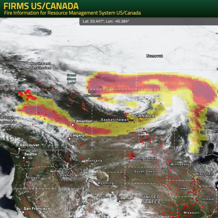
Active fire detection data from five geostationary sensors are available in NASA's Fire Information for Resource Management System (FIRMS) and collectively provide global coverage.
Blog
June 27, 2024

Global and US/Canada active Fire Maps enable users to visualize the location, extent, and impact of wildfires with minimal delay.
Feature Article
June 24, 2024
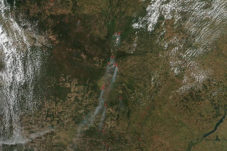
Image captured on June 12, 2024, by the VIIRS instrument aboard the joint NASA/NOAA Suomi NPP satellite.
Worldview Image of the Week
June 13, 2024

Data from NASA's Fire Information for Resource Management System (FIRMS) help personnel in Canada's Northwest Territories Department of Environment and Climate Change manage wildfires.
Feature Article
June 11, 2024
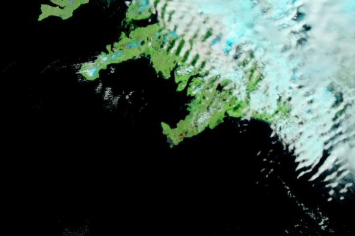
Image captured on June 5, 2024, by the VIIRS instrument aboard the joint NASA/NOAA Suomi NPP satellite.
Worldview Image of the Week
June 6, 2024

A summary of datasets, products, and resources released by NASA's Distributed Active Archive Centers (DAACs) in May 2024.
News
June 6, 2024
NASA’s Fire Information for Resource Management System (FIRMS) provides natural resource managers with near real-time active fire/hotspot locations using satellite-derived fire information.
Blog
May 24, 2024
SHOWING 8 OF 333
Frequently Asked Questions
Earthdata Forum
Our online forum provides a space for users to browse thousands of FAQs about research needs, data, and data applications. You can also submit new questions for our experts to answer.
Submit Questions to Earthdata Forumand View Expert Responses