We are in the process of migrating all NASA Earth science data sites into Earthdata from now until end of 2026. Not all NASA Earth science data and resources will appear here until then. Thank you for your patience as we make this transition.
Read about the Web Unification Project
Suomi NPP Resources
Suomi NPP Learning Resources

Esta capacitación de ARSET se centra en los datos de Black Marble y en cómo elegir el producto de iluminación nocturna adecuado.
Training
Dec. 3, 2020
This ARSET training focuses on building the skills needed to acquire and understand Black Marble data and choose the appropriate nighttime lights product.
Training
Dec. 3, 2020

This ARSET training covers the use of remote sensing in determining and explaining urban heat islands, and ways to mitigate the effects.
Training
Nov. 10-24, 2020

During this webinar we will introduce several of the NSIDC DAAC snow-focused NASA missions and data products, followed by a live demonstration teaching participants how to discover, access, and couple snow data across varying geospatial scales using Python.
Webinar
Nov. 4, 2020

This ARSET training covers how to access VIIRS data products, the differences between VIIRS and MODIS, and its air quality applications.
Training
Oct. 22, 2020

Esta formación ARSET abarca algunas de las dificultades asociadas a la teledetección de los ecosistemas costeros.
Training
Aug. 25 - Sept. 8, 2020
This ARSET training covers some of the difficulties associated with remote sensing of coastal ecosystems.
Training
Aug. 25 - Sept. 8, 2020

This ArcGIS Python Toolbox simplifies access to quality data by decoding complex quality information into usable thematic raster files.
Tutorial
Aug. 18, 2020
SHOWING 8 OF 67
Suomi NPP News
View All News
Filters
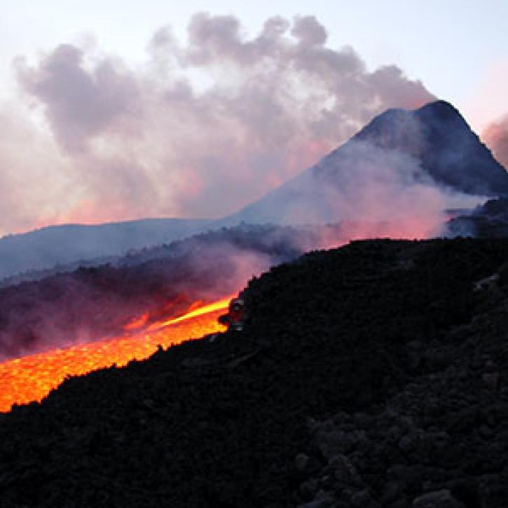
Tracking a volcanic plume reaches new heights, faster.
Feature Article
March 1, 2021
NASA's Level-1 and Atmosphere Archive and Distribution System Distributed Active Archive Center has joined the Earthdata Forum, NASA's interactive platform that gives data users the chance to communicate with and learn from experts.
News
March 1, 2021

Global climate change is leading to shifts in vital ecosystems. Dr. Malone uses Earth observation data to explore how a changing climate impacts ecosystem structure and function.
Data User Story
Feb. 25, 2021

Image captured on 31 January 2021, by the VIIRS instrument, aboard the joint NASA/NOAA Suomi NPP satellite.
Worldview Image of the Week
Feb. 8, 2021

Our atmosphere is a chemical soup that is constantly sampled by orbiting Earth observing satellites. Dr. Emily Fischer uses these data to better understand how pollutants move in the lower atmosphere.
Data User Story
Jan. 7, 2021


As rapid urbanization transforms India's landscape, doctors face a new set of challenges in protecting public health.
Feature Article
Dec. 28, 2020

Who uses NASA Earth science data? Dr. Michael Dietze, to improve ecological models through the integration of remotely-sensed data.
Data User Story
Dec. 22, 2020
SHOWING 8 OF 333
Frequently Asked Questions
Earthdata Forum
Our online forum provides a space for users to browse thousands of FAQs about research needs, data, and data applications. You can also submit new questions for our experts to answer.
Submit Questions to Earthdata Forumand View Expert Responses