We are in the process of migrating all NASA Earth science data sites into Earthdata from now until end of 2026. Not all NASA Earth science data and resources will appear here until then. Thank you for your patience as we make this transition.
Read about the Web Unification Project
Webinars
Our online webinars, trainings, and workshops feature experts in various disciplines who share their knowledge in a particular subject area, from data in the cloud to specific data tools.
Featured Webinars

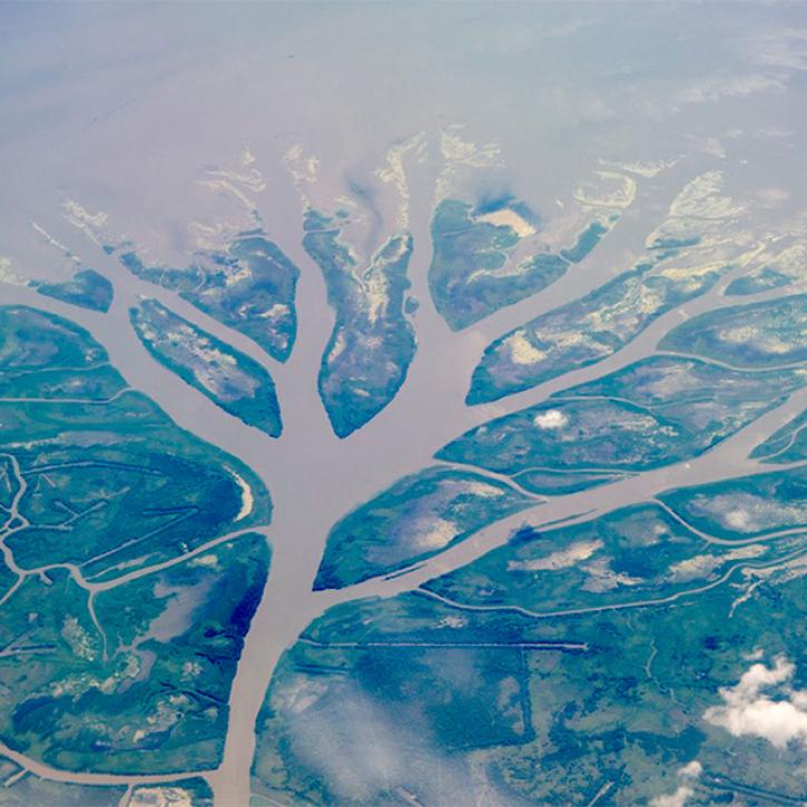
This NASA web-based tool enables near-real time monitoring of inland and coastal water quality across the U.S. and parts of Africa and South America.
July 1, 2026,2:00-3:00 p.m. EDT(1800-1900 UTC)

Learn how the Fire Information for Resource Management System (FIRMS) uses timely composite imagery to identify fire fronts, burned areas, and smoke.
July 16, 2026,2:00-3:30 p.m. EDT(1800-1930 UTC)

Diane Fritz, an associate scientist at NSIDC DAAC, demonstrates how to use the harmony-py Python library to customize data requests from the NASA Earthdata Cloud.
June 2, 2026,3:00-3:30 p.m. EDT(1900-1930 UTC)
Filters

Due to unforeseen circumstances, this webinar is postponed and will be rescheduled soon. We apologize for the short notice and appreciate your continued interest and support. We look forward to your attendance at our rescheduled webinar, to be announced.
July 17, 2024,2:00-3:15 p.m. EDT(1800-1915 UTC)
This webinar presents an overview of NASA's Delta-X mission and data, including demonstrations for finding, accessing, and working with Delta-X datasets using tools, services, and Jupyter Notebooks.
June 26, 2024,2:00-3:15 p.m. EDT(1800-1915 UTC)

This webinar introduces the Geostationary Earth Orbit (GEO)-Low-Earth Orbit (LEO) Dark Target Aerosol data product suite and shows how to find, access, and download the data.
June 10, 2024,2:00-3:15 p.m. EDT(1800-1915 UTC)

This webinar provides an overview of the TEMPO mission and its data products and shows how to discover and access TEMPO data products using NASA's Earthdata Search.
May 29, 2024,2:00-3:15 p.m. EDT(1800-1915 UTC)
Join representatives from NASA's Land Processes Distributed Active Archive Center (LP DAAC) to explore NASA's Earth Surface Mineral Dust Source Investigation (EMIT) data resources.
April 30, 2024,1:00-2:00 p.m. EDT(1700-1800 UTC)

Learn more about NASA's Application for Extracting and Exploring Analysis Ready Samples (AppEEARS). This webinar showcases the system's capabilities and highlights learning resources to help simplify data access workflows using AppEEARS.
April 24, 2024,2:00-3:15 p.m. EDT(1800-1915 UTC)
Join NASA scientists and other decision-makers on Thursday, April 11, to explore the many ways NASA Earth science data are helping us to better understand and protect Earth—and how you can make a positive difference in improving life on our planet.
April 11, 2024,8:00-9:00 p.m. EDT(0000-0100 UTC)
Join members of NASA's Ocean Biology Distributed Active Archive Center (OB.DAAC) to learn about data from the Plankton, Aerosol, Cloud, ocean Ecosystem (PACE) mission and how to discover, access, and use PACE data.
March 27, 2024,2:00-3:00 p.m. EDT(1800-1900 UTC)
SHOWING 8 OF 205